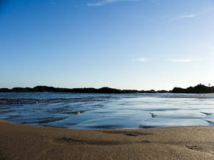
 Amaralina and Pituba Beach - MAP 7
The two beaches are located in the Pituba neighborhood in Salvador roughly 10 km from the city center. The large and dangerous waves, along with pollution make it unsuitable for bathing. However the neighborhood where the beach is located is highly populated with many bars and restaurants parallel to the beaches. Amaralina and Pituba beaches are popular with joggers and people walking in the sand, enjoying the scene... Amaralina and Pituba Beach - MAP 7
The two beaches are located in the Pituba neighborhood in Salvador roughly 10 km from the city center. The large and dangerous waves, along with pollution make it unsuitable for bathing. However the neighborhood where the beach is located is highly populated with many bars and restaurants parallel to the beaches. Amaralina and Pituba beaches are popular with joggers and people walking in the sand, enjoying the scene... |
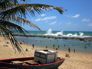 Arembepe Beach - MAP 7
A sparsely populated area, Arembepe Beach has many natural pools formed by the reefs offshore and available at low tide. Several stretches with waves attract surfers and other water sports enthusiasts. It's proximity to Salvador makes it a weekend destination for many city folks, with stunning surroundings all around. Jacuípe Bar is just 15 km away, which is a popular village that visitors of... Arembepe Beach - MAP 7
A sparsely populated area, Arembepe Beach has many natural pools formed by the reefs offshore and available at low tide. Several stretches with waves attract surfers and other water sports enthusiasts. It's proximity to Salvador makes it a weekend destination for many city folks, with stunning surroundings all around. Jacuípe Bar is just 15 km away, which is a popular village that visitors of... |
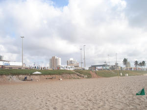 Armação Beach - MAP 7
With strong waves, surfers are often bound visiting Armação Beach which is located in the neighborhood of Armação in Salvador.
The beach has large waves and is almost exclusively used for fishing and surfing. You will often see people fishing from the beach here, or surfers enjoying themselves out in the strong waves, but rarely will anyone use the waters for swimming in. The boardwalk bord... Armação Beach - MAP 7
With strong waves, surfers are often bound visiting Armação Beach which is located in the neighborhood of Armação in Salvador.
The beach has large waves and is almost exclusively used for fishing and surfing. You will often see people fishing from the beach here, or surfers enjoying themselves out in the strong waves, but rarely will anyone use the waters for swimming in. The boardwalk bord... |
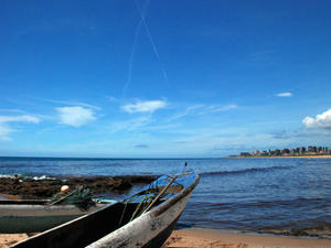 Boca do Rio Beach - 7 Murky waters, and really not fit for bathing. This stretch of beach is also known as the Artistas Beach and is quite busy and full of kiosks. The secondary name is given to the beach as there are often many artists, musicians and other artistic related people on the beach. Boca do Rio Beach - 7 Murky waters, and really not fit for bathing. This stretch of beach is also known as the Artistas Beach and is quite busy and full of kiosks. The secondary name is given to the beach as there are often many artists, musicians and other artistic related people on the beach. |
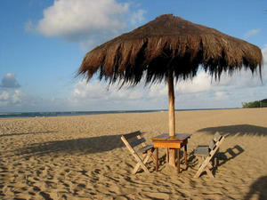 Boipeba Island - MAP With 20 miles of semi-deserted beaches, the island of Boipeba is an invitation to anonymity.The difficult access is the one responsible for maintaining the "secret" this pearl of the coast of Bahia. Virtually intact, almost wild, Boipeba Island also has a little help from the local population, which strives to preserve nature and guide the tourists to leave everything just the way he found, indeed, as ever.Human intervention is viewed w... Boipeba Island - MAP With 20 miles of semi-deserted beaches, the island of Boipeba is an invitation to anonymity.The difficult access is the one responsible for maintaining the "secret" this pearl of the coast of Bahia. Virtually intact, almost wild, Boipeba Island also has a little help from the local population, which strives to preserve nature and guide the tourists to leave everything just the way he found, indeed, as ever.Human intervention is viewed w... |
| Bom Jesus dos Passos - MAP 7
Access here is by boat only, as it is an island and it is situated between Madre de Deus Island and Frades Island. Boats usually moor off the coast in from of the church of Bom Jesus dos Passos. Once on land, it's possible to walk down many of the quiet streets here, where the population is mostly fishermen and carpentry workers. Several of the buildings are interesting to visit, includ the Porrãozi... |
| Corsário Beach - MAP 7
This is one of the most popular beaches in Salvardor for surfers who meet up regularly here. Corsário Beach is an inlet to the ocean and has strong waves, which makes it great for the surfers who come here. The sandy beach is wide, which allows others to come here and play soccer and volleyball. While at low tide, the waves are far smaller allowing people to bath and enjoy the waters. While the be... |
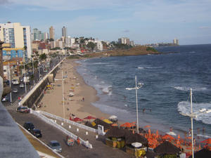 Farol da Barra Beach - MAP 7
Celebrations of the city, such as Eve are done here are Farol da Barra Beach, which is also the location of St. Anthony Fort and where the navigator Amerigo Vespucci arrived in 1501 and planted the Portuguese flag. Today this is where the Fort and Lighhouse Bar are located and a big tourist destination in Salvador.
The image of the Farol da Barra Beach and the Lacerda Elevator is probably one of the best known in... Farol da Barra Beach - MAP 7
Celebrations of the city, such as Eve are done here are Farol da Barra Beach, which is also the location of St. Anthony Fort and where the navigator Amerigo Vespucci arrived in 1501 and planted the Portuguese flag. Today this is where the Fort and Lighhouse Bar are located and a big tourist destination in Salvador.
The image of the Farol da Barra Beach and the Lacerda Elevator is probably one of the best known in... |
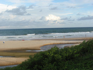 Flamengo Beach - MAP 2
The wilderness - it has no avenue by the sea and is bordered by dunes and coconut trees - it's Flamengo beach one of the most beautiful beaches of Salvador.
There are few good and many kiosks and waves that attract surfers.
The stretch known as Hallelujah is the meeting point for couples classes. In the tent of Loro, stewardship reigns, complete with deck chairs covered with mat an... Flamengo Beach - MAP 2
The wilderness - it has no avenue by the sea and is bordered by dunes and coconut trees - it's Flamengo beach one of the most beautiful beaches of Salvador.
There are few good and many kiosks and waves that attract surfers.
The stretch known as Hallelujah is the meeting point for couples classes. In the tent of Loro, stewardship reigns, complete with deck chairs covered with mat an... |
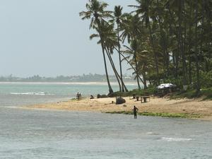 Forte Beach - MAP 3 Located 70 kilometers from Salvador, Praia do Forte has 14 km, being full of natural beauty to behold and a variety of entertainment.
The border has palm trees, white sands, coral reefs and crystal-clear sea full of colored schools. Around it are must-sees, as the Garcia D'Ávila Castle, the first Portuguese construction of residential architecture in military Brazil, the national headquarters of the Tamar and the Humpback Whale Inst... Forte Beach - MAP 3 Located 70 kilometers from Salvador, Praia do Forte has 14 km, being full of natural beauty to behold and a variety of entertainment.
The border has palm trees, white sands, coral reefs and crystal-clear sea full of colored schools. Around it are must-sees, as the Garcia D'Ávila Castle, the first Portuguese construction of residential architecture in military Brazil, the national headquarters of the Tamar and the Humpback Whale Inst... |
 Gamboa Beach - 7
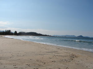
On the banks of the small cove of Praia da Gamboa is a very popular place with divers and local residents. The waters are calm in its entirety, with only a small narrow strip of sand and with no tourism infrastructure, which limits the number of visitors to the area. It features a beautiful panoramic view of the City and the Bay of All Saints, especially from the Solar Unhão, which was built in the seventeenth century. &n... Gamboa Beach - 7
On the banks of the small cove of Praia da Gamboa is a very popular place with divers and local residents. The waters are calm in its entirety, with only a small narrow strip of sand and with no tourism infrastructure, which limits the number of visitors to the area. It features a beautiful panoramic view of the City and the Bay of All Saints, especially from the Solar Unhão, which was built in the seventeenth century. &n... |
| Ilha da Maré - MAP It is located in the center of the Bay of All Saints, near the Port of Aratu.To get there it becomes boats from Salvador, Praia de São Tomé de Paripe or Ferry Terminal. The boats leave every hour on the hour and the trip is about 30 minutes.Its main beaches are: Itamoabo, das Neves, Praia Grande, Botelho de Santana and Oratory or Tide.This beautiful island, formed by small villages, is rich in vegetation but has no fresh water. In the... |
 Ilha de Madre de Deus - MAP 3
ISLE OF MOTHER OF GOD
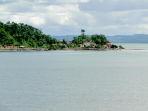
This island is roughly 70 km away from Salvador, with access via car or bus.
It is a city of great importance due to the existence of the maritime terminal of Petrobras. They are part of the City Guard and Maria Island beach Suape. Most notable are the buildings at the top of the Matrix, the homes of Peter and Laudelino Pinheiro Gomes, and on the beach in the House of Suape Tw... Ilha de Madre de Deus - MAP 3
ISLE OF MOTHER OF GOD
This island is roughly 70 km away from Salvador, with access via car or bus.
It is a city of great importance due to the existence of the maritime terminal of Petrobras. They are part of the City Guard and Maria Island beach Suape. Most notable are the buildings at the top of the Matrix, the homes of Peter and Laudelino Pinheiro Gomes, and on the beach in the House of Suape Tw... |
 Ilha do Mêdo Itaparica - MAP 7
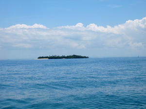
One of the smallest of the Bay of All Saints islands, with an area of only 12,000 square meters, Ilha do Mêdo Itaparica belongs to the city of Itaparica. This island is uninhabited today because it lacks any source of freshwater. It is the first Ecological Station of the Bay of All Saints and its predominant vegetation is lush with a forest of mangrove trees.
The island is shrouded in mystery and lege... Ilha do Mêdo Itaparica - MAP 7
One of the smallest of the Bay of All Saints islands, with an area of only 12,000 square meters, Ilha do Mêdo Itaparica belongs to the city of Itaparica. This island is uninhabited today because it lacks any source of freshwater. It is the first Ecological Station of the Bay of All Saints and its predominant vegetation is lush with a forest of mangrove trees.
The island is shrouded in mystery and lege... |
 Ilhas Bimbarras - MAP 7
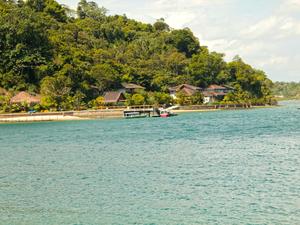
Access is via boat only, the island is 17 nautical miles from Salvador and is part of an eco tourism project in the Bay of all Saints.
The project on Ilhas Bimbarras is an example of preservation of rain forest, based on the principle of balance that exists in the whole ecosystem, where man must not only occupy it in a rational way, but retrieve it and preserve it. This project is characterized by its self-sustai... Ilhas Bimbarras - MAP 7
Access is via boat only, the island is 17 nautical miles from Salvador and is part of an eco tourism project in the Bay of all Saints.
The project on Ilhas Bimbarras is an example of preservation of rain forest, based on the principle of balance that exists in the whole ecosystem, where man must not only occupy it in a rational way, but retrieve it and preserve it. This project is characterized by its self-sustai... |
| Isle of Friars - MAP 7
Declared an ecological reserve in 1982, the Isle of Friars occupies an area of approximately 1,335 hectares, with many beautiful beaches, palm trees, lakes, waterfalls and typical Atlantic vegetation including many native Brazilian trees. You can actually walk around the entire island on foot at low tide.
Marine tourism and recreational sports are heavily practiced here, thanks to the quiet beaches. Scuba diving... |
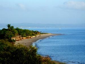 Itaparica Island - MAP It is the largest maritime island in Brazil with 239 km ² offering beautiful landscapes formed by tropical vegetation, surrounded by coral beaches, historic monuments and an excellent urban infrastructure. It is located 31.5 nautical miles (17 km) from Salvador and its main access is through the Terminal Marítimo de São Joaquim (Ferry Boat or catamaran) with about 40 minutes away and landing in Terminal maritime Good Dispatch there, ... Itaparica Island - MAP It is the largest maritime island in Brazil with 239 km ² offering beautiful landscapes formed by tropical vegetation, surrounded by coral beaches, historic monuments and an excellent urban infrastructure. It is located 31.5 nautical miles (17 km) from Salvador and its main access is through the Terminal Marítimo de São Joaquim (Ferry Boat or catamaran) with about 40 minutes away and landing in Terminal maritime Good Dispatch there, ... |
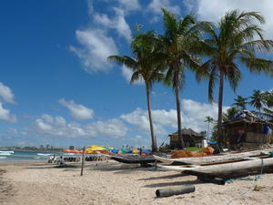 Itapuã Beach - MAP 7
Most famous beach in Salvador, Itapuã Beach is actually used on a postcard. Beyond the lighthouse, there are green waters, rocks, palm trees, natural pools and white sand. Stalls serving snacks, cold beverages and fruits from the region are all available.
Even if you've never heard of this beach, there is a good chance you've heard the lyrics of Vinicius de Moraes and Toquinho which have ... Itapuã Beach - MAP 7
Most famous beach in Salvador, Itapuã Beach is actually used on a postcard. Beyond the lighthouse, there are green waters, rocks, palm trees, natural pools and white sand. Stalls serving snacks, cold beverages and fruits from the region are all available.
Even if you've never heard of this beach, there is a good chance you've heard the lyrics of Vinicius de Moraes and Toquinho which have ... |
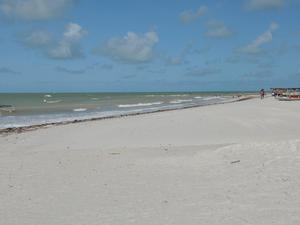 Jaguaribe Beach - MAP 7
This urban beach has calm seas and a good set of huts which provide food, cold beverages and beer. Jaguaribe is one of the most competitive beaches of Salvador, with whit sand and calm waters, and a walkway lined with coconut trees, this beach is considered one of the top three beaches in Salvador. Tourists are attracted here in droves, and the nearby hotels ensure there are endless supplies of tourists for the... Jaguaribe Beach - MAP 7
This urban beach has calm seas and a good set of huts which provide food, cold beverages and beer. Jaguaribe is one of the most competitive beaches of Salvador, with whit sand and calm waters, and a walkway lined with coconut trees, this beach is considered one of the top three beaches in Salvador. Tourists are attracted here in droves, and the nearby hotels ensure there are endless supplies of tourists for the... |
| Jardin de Allah Beach - MAP 7
The warm sea water has strong waves and currents due and is roughly 12 km from the city center, but still considered an urban beach. With a peculiar beauty, this beach is called the Garden of Allah, with coconut trees that have been incorporated into the city's landscape ever since urbanization began in the region. Jardin de Allah Beach has a great view of the coast of Salvador. It has a huge lawn in front with ... |
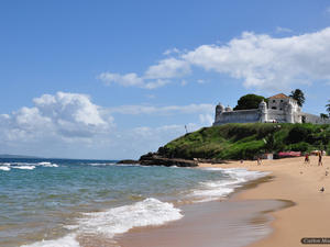 Monte Serrat Beach - MAP 3 Located at the southern tip of the peninsula, where you can enjoy a beautiful sunset framed by the blue waters and some of the 36 islands of the Bay of All Saints. Ponta de Monte Serrat is now known as Ponta Humaitá. This place is the lighthouse and a small Humaitá religious complex formed by the Church and Monastery of Our Lady of Mount Cerra, a remarkable collection of seventeenth century colonial. On the hill stands the Fort of Our... Monte Serrat Beach - MAP 3 Located at the southern tip of the peninsula, where you can enjoy a beautiful sunset framed by the blue waters and some of the 36 islands of the Bay of All Saints. Ponta de Monte Serrat is now known as Ponta Humaitá. This place is the lighthouse and a small Humaitá religious complex formed by the Church and Monastery of Our Lady of Mount Cerra, a remarkable collection of seventeenth century colonial. On the hill stands the Fort of Our... |
 Ondina Beach - MAP 7
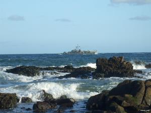
This small but famous beach has strong waves and snippets of reefs which form natural pools during low tide. Ondina is one of the most frequented beaches in Salvador, only 7 km from the city enter and divided into three sections, Ondina Beach is the places for those seeking natural pools for bathing, and good waves for surfing. Ondina offers up a pristine tourist infrastructure, in part because this is where many of the h... Ondina Beach - MAP 7
This small but famous beach has strong waves and snippets of reefs which form natural pools during low tide. Ondina is one of the most frequented beaches in Salvador, only 7 km from the city enter and divided into three sections, Ondina Beach is the places for those seeking natural pools for bathing, and good waves for surfing. Ondina offers up a pristine tourist infrastructure, in part because this is where many of the h... |
 Patamares Beach - MAP 7
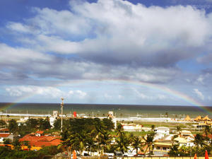
Youth with bronzed skin enjoy surfing here on the strong waves that hit the beach. Along with surfing, Patamares Beach has a good selection of tents, kiosks and restaurants. One of the most famous in Salvador is the Restaurant of Dada, which is almost situated in the sea, it's definitely worth waiting for a table. Patamares Beach - MAP 7
Youth with bronzed skin enjoy surfing here on the strong waves that hit the beach. Along with surfing, Patamares Beach has a good selection of tents, kiosks and restaurants. One of the most famous in Salvador is the Restaurant of Dada, which is almost situated in the sea, it's definitely worth waiting for a table.
|
 Piatã Beach - MAP 7
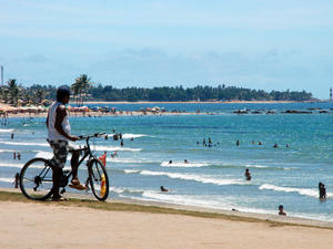
Much sought after by tourists and residents, Piatã Beach has calm waters, coconut trees, yellow sand and many tents and kiosks which sell snacks, cold beverages and beer on the beach. The beach is open, long and straight with yellow sand and very large coconut trees. Unlike some of the other beaches in the area, this beach remains calm, even at high dies and is much more frequented by familieis with children.... Piatã Beach - MAP 7
Much sought after by tourists and residents, Piatã Beach has calm waters, coconut trees, yellow sand and many tents and kiosks which sell snacks, cold beverages and beer on the beach. The beach is open, long and straight with yellow sand and very large coconut trees. Unlike some of the other beaches in the area, this beach remains calm, even at high dies and is much more frequented by familieis with children.... |
 Pituaçu Beach - MAP 7
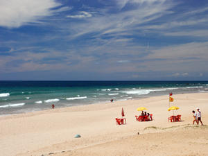
Located in the Pituaçu neighborhood, Pituaçu Beach is protected by reefs, which ensure only small waves run through the area. 17 km from the city center, and in the southern park of the city this great beauty boasts beautiful coconut trees and small dunes. Also knows as Praia dos Artistas or Artists Beach, it was the meeting point for many artists, bohemians, musicians poets and intellectuals in the la... Pituaçu Beach - MAP 7
Located in the Pituaçu neighborhood, Pituaçu Beach is protected by reefs, which ensure only small waves run through the area. 17 km from the city center, and in the southern park of the city this great beauty boasts beautiful coconut trees and small dunes. Also knows as Praia dos Artistas or Artists Beach, it was the meeting point for many artists, bohemians, musicians poets and intellectuals in the la... |
 Placaford Beach - MAP 7
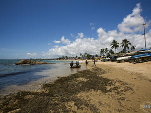
Located in the Piatã neighborhood, we find the Placaford Beach, between the beach of Itapuã Beach and downtown which is roughly 20 km away. The Placaford Beach name came about because of Ford automobile company's promotional card which stood in front of the beach and which was considered very fashionable during the 60s.
Calm waves and warm waters mark this beach, and natural pools for... Placaford Beach - MAP 7
Located in the Piatã neighborhood, we find the Placaford Beach, between the beach of Itapuã Beach and downtown which is roughly 20 km away. The Placaford Beach name came about because of Ford automobile company's promotional card which stood in front of the beach and which was considered very fashionable during the 60s.
Calm waves and warm waters mark this beach, and natural pools for... |
 Porto da Barra Beach - MAP 7
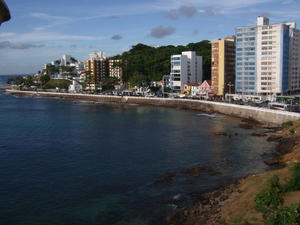
The beach has simple tents, clean water and calm seas suitable for bathing, which makes it one of the most sought after beaches on the weekends. During the week it is far quieter. A nice attraction is the night lighting, which ensures an active area even after the sun goes down. Porto da Barra is furthest point out into the ocean around Salvador, and it's also the place where the Atlantic Ocean meets the Baía de Todo... Porto da Barra Beach - MAP 7
The beach has simple tents, clean water and calm seas suitable for bathing, which makes it one of the most sought after beaches on the weekends. During the week it is far quieter. A nice attraction is the night lighting, which ensures an active area even after the sun goes down. Porto da Barra is furthest point out into the ocean around Salvador, and it's also the place where the Atlantic Ocean meets the Baía de Todo... |
 Ribeira Beach - MAP 7
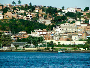
Considered one of the most charming beaches in Salvador, Praia da Ribeira has a very calm bay, where the water is nearly mirrored at times and is used for training and competitions for waters sports such as rowing, sailing and canoeing competitions where the calm water is a necessity for the competitions. Previously the calm waters of the cove had been used for landing airplanes, and today the old station that received the plan... Ribeira Beach - MAP 7
Considered one of the most charming beaches in Salvador, Praia da Ribeira has a very calm bay, where the water is nearly mirrored at times and is used for training and competitions for waters sports such as rowing, sailing and canoeing competitions where the calm water is a necessity for the competitions. Previously the calm waters of the cove had been used for landing airplanes, and today the old station that received the plan... |
 Rio Vermelho Beach - MAP 7
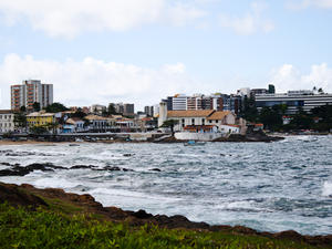
This area is known for it's night life, and partying Salvador, with many bars, restaurants and hotels. The Rio Vermelho Beach was historically preferred by the wealth families of Salvador, who would spend their summers there. Now the beach searches as a port for the local fishermen and a docking area for their vessels. The water has become very polluted and is no longer suitable for swimming, but the real beauty... Rio Vermelho Beach - MAP 7
This area is known for it's night life, and partying Salvador, with many bars, restaurants and hotels. The Rio Vermelho Beach was historically preferred by the wealth families of Salvador, who would spend their summers there. Now the beach searches as a port for the local fishermen and a docking area for their vessels. The water has become very polluted and is no longer suitable for swimming, but the real beauty... |
| South Coast of Bahia - MAP 2
The south coast of Bahia is dotted with many Beaches.
Caravelas
Starting point to visit the Abrolhos Marine National Park, one of the best diving points in the country. Between July and November, the presence of humpback whales in the archipelago further leverage the presence of tourists.
Meadow
During the season, the most central beaches are full - not surprisingly, there are concerts almost every night of ax&ea... |
 Stella Maris Beach - MAP 7
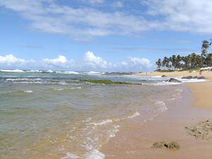
With good waves for surfers and warm green water, Stella Maris Beach is perfect for surfing. At high tide the waves are strong, and at low tide, natural tidal pools emerge, where children can swim and enjoy themselves, without worrying their parents of the dangers of the sea. Jet skiing and body boarding are also popular at this beach due to ocean conditions here.
During high season, there are many ki... Stella Maris Beach - MAP 7
With good waves for surfers and warm green water, Stella Maris Beach is perfect for surfing. At high tide the waves are strong, and at low tide, natural tidal pools emerge, where children can swim and enjoy themselves, without worrying their parents of the dangers of the sea. Jet skiing and body boarding are also popular at this beach due to ocean conditions here.
During high season, there are many ki... |
 Valentine Garden Beach - MAP 7
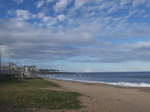
Located in the neighborhood of Pituba, Jardim dos Namorados Beach begins after the Portuguese Club in the park of the Jardim dos Namorados. The beach has rough seas, with many stones which makes it a little too dangerous for swimming, however the beach is really about leisurely strolling and not about aquatic activities. Jardim dos Namorados Beach, also has sports fields, a large lawn and a playground for the kids. &... Valentine Garden Beach - MAP 7
Located in the neighborhood of Pituba, Jardim dos Namorados Beach begins after the Portuguese Club in the park of the Jardim dos Namorados. The beach has rough seas, with many stones which makes it a little too dangerous for swimming, however the beach is really about leisurely strolling and not about aquatic activities. Jardim dos Namorados Beach, also has sports fields, a large lawn and a playground for the kids. &... |
 Amaralina and Pituba Beach - MAP 7
The two beaches are located in the Pituba neighborhood in Salvador roughly 10 km from the city center. The large and dangerous waves, along with pollution make it unsuitable for bathing. However the neighborhood where the beach is located is highly populated with many bars and restaurants parallel to the beaches. Amaralina and Pituba beaches are popular with joggers and people walking in the sand, enjoying the scene...
 Arembepe Beach - MAP 7
A sparsely populated area, Arembepe Beach has many natural pools formed by the reefs offshore and available at low tide. Several stretches with waves attract surfers and other water sports enthusiasts. It's proximity to Salvador makes it a weekend destination for many city folks, with stunning surroundings all around. Jacuípe Bar is just 15 km away, which is a popular village that visitors of...
 Armação Beach - MAP 7
With strong waves, surfers are often bound visiting Armação Beach which is located in the neighborhood of Armação in Salvador.
The beach has large waves and is almost exclusively used for fishing and surfing. You will often see people fishing from the beach here, or surfers enjoying themselves out in the strong waves, but rarely will anyone use the waters for swimming in. The boardwalk bord...
 Boca do Rio Beach - 7 Murky waters, and really not fit for bathing. This stretch of beach is also known as the Artistas Beach and is quite busy and full of kiosks. The secondary name is given to the beach as there are often many artists, musicians and other artistic related people on the beach.
 Boipeba Island - MAP With 20 miles of semi-deserted beaches, the island of Boipeba is an invitation to anonymity.The difficult access is the one responsible for maintaining the "secret" this pearl of the coast of Bahia. Virtually intact, almost wild, Boipeba Island also has a little help from the local population, which strives to preserve nature and guide the tourists to leave everything just the way he found, indeed, as ever.Human intervention is viewed w...
 Farol da Barra Beach - MAP 7
Celebrations of the city, such as Eve are done here are Farol da Barra Beach, which is also the location of St. Anthony Fort and where the navigator Amerigo Vespucci arrived in 1501 and planted the Portuguese flag. Today this is where the Fort and Lighhouse Bar are located and a big tourist destination in Salvador.
The image of the Farol da Barra Beach and the Lacerda Elevator is probably one of the best known in...
 Flamengo Beach - MAP 2
The wilderness - it has no avenue by the sea and is bordered by dunes and coconut trees - it's Flamengo beach one of the most beautiful beaches of Salvador.
There are few good and many kiosks and waves that attract surfers.
The stretch known as Hallelujah is the meeting point for couples classes. In the tent of Loro, stewardship reigns, complete with deck chairs covered with mat an...
 Forte Beach - MAP 3 Located 70 kilometers from Salvador, Praia do Forte has 14 km, being full of natural beauty to behold and a variety of entertainment.
The border has palm trees, white sands, coral reefs and crystal-clear sea full of colored schools. Around it are must-sees, as the Garcia D'Ávila Castle, the first Portuguese construction of residential architecture in military Brazil, the national headquarters of the Tamar and the Humpback Whale Inst...
 Gamboa Beach - 7
On the banks of the small cove of Praia da Gamboa is a very popular place with divers and local residents. The waters are calm in its entirety, with only a small narrow strip of sand and with no tourism infrastructure, which limits the number of visitors to the area. It features a beautiful panoramic view of the City and the Bay of All Saints, especially from the Solar Unhão, which was built in the seventeenth century. &n...
 Ilha de Madre de Deus - MAP 3
ISLE OF MOTHER OF GOD
This island is roughly 70 km away from Salvador, with access via car or bus.
It is a city of great importance due to the existence of the maritime terminal of Petrobras. They are part of the City Guard and Maria Island beach Suape. Most notable are the buildings at the top of the Matrix, the homes of Peter and Laudelino Pinheiro Gomes, and on the beach in the House of Suape Tw...
 Ilha do Mêdo Itaparica - MAP 7
One of the smallest of the Bay of All Saints islands, with an area of only 12,000 square meters, Ilha do Mêdo Itaparica belongs to the city of Itaparica. This island is uninhabited today because it lacks any source of freshwater. It is the first Ecological Station of the Bay of All Saints and its predominant vegetation is lush with a forest of mangrove trees.
The island is shrouded in mystery and lege...
 Ilhas Bimbarras - MAP 7
Access is via boat only, the island is 17 nautical miles from Salvador and is part of an eco tourism project in the Bay of all Saints.
The project on Ilhas Bimbarras is an example of preservation of rain forest, based on the principle of balance that exists in the whole ecosystem, where man must not only occupy it in a rational way, but retrieve it and preserve it. This project is characterized by its self-sustai...
 Itaparica Island - MAP It is the largest maritime island in Brazil with 239 km ² offering beautiful landscapes formed by tropical vegetation, surrounded by coral beaches, historic monuments and an excellent urban infrastructure. It is located 31.5 nautical miles (17 km) from Salvador and its main access is through the Terminal Marítimo de São Joaquim (Ferry Boat or catamaran) with about 40 minutes away and landing in Terminal maritime Good Dispatch there, ...
 Itapuã Beach - MAP 7
Most famous beach in Salvador, Itapuã Beach is actually used on a postcard. Beyond the lighthouse, there are green waters, rocks, palm trees, natural pools and white sand. Stalls serving snacks, cold beverages and fruits from the region are all available.
Even if you've never heard of this beach, there is a good chance you've heard the lyrics of Vinicius de Moraes and Toquinho which have ...
 Jaguaribe Beach - MAP 7
This urban beach has calm seas and a good set of huts which provide food, cold beverages and beer. Jaguaribe is one of the most competitive beaches of Salvador, with whit sand and calm waters, and a walkway lined with coconut trees, this beach is considered one of the top three beaches in Salvador. Tourists are attracted here in droves, and the nearby hotels ensure there are endless supplies of tourists for the...
 Monte Serrat Beach - MAP 3 Located at the southern tip of the peninsula, where you can enjoy a beautiful sunset framed by the blue waters and some of the 36 islands of the Bay of All Saints. Ponta de Monte Serrat is now known as Ponta Humaitá. This place is the lighthouse and a small Humaitá religious complex formed by the Church and Monastery of Our Lady of Mount Cerra, a remarkable collection of seventeenth century colonial. On the hill stands the Fort of Our...
 Ondina Beach - MAP 7
This small but famous beach has strong waves and snippets of reefs which form natural pools during low tide. Ondina is one of the most frequented beaches in Salvador, only 7 km from the city enter and divided into three sections, Ondina Beach is the places for those seeking natural pools for bathing, and good waves for surfing. Ondina offers up a pristine tourist infrastructure, in part because this is where many of the h...
 Patamares Beach - MAP 7
Youth with bronzed skin enjoy surfing here on the strong waves that hit the beach. Along with surfing, Patamares Beach has a good selection of tents, kiosks and restaurants. One of the most famous in Salvador is the Restaurant of Dada, which is almost situated in the sea, it's definitely worth waiting for a table.
 Piatã Beach - MAP 7
Much sought after by tourists and residents, Piatã Beach has calm waters, coconut trees, yellow sand and many tents and kiosks which sell snacks, cold beverages and beer on the beach. The beach is open, long and straight with yellow sand and very large coconut trees. Unlike some of the other beaches in the area, this beach remains calm, even at high dies and is much more frequented by familieis with children....
 Pituaçu Beach - MAP 7
Located in the Pituaçu neighborhood, Pituaçu Beach is protected by reefs, which ensure only small waves run through the area. 17 km from the city center, and in the southern park of the city this great beauty boasts beautiful coconut trees and small dunes. Also knows as Praia dos Artistas or Artists Beach, it was the meeting point for many artists, bohemians, musicians poets and intellectuals in the la...
 Placaford Beach - MAP 7
Located in the Piatã neighborhood, we find the Placaford Beach, between the beach of Itapuã Beach and downtown which is roughly 20 km away. The Placaford Beach name came about because of Ford automobile company's promotional card which stood in front of the beach and which was considered very fashionable during the 60s.
Calm waves and warm waters mark this beach, and natural pools for...
 Porto da Barra Beach - MAP 7
The beach has simple tents, clean water and calm seas suitable for bathing, which makes it one of the most sought after beaches on the weekends. During the week it is far quieter. A nice attraction is the night lighting, which ensures an active area even after the sun goes down. Porto da Barra is furthest point out into the ocean around Salvador, and it's also the place where the Atlantic Ocean meets the Baía de Todo...
 Ribeira Beach - MAP 7
Considered one of the most charming beaches in Salvador, Praia da Ribeira has a very calm bay, where the water is nearly mirrored at times and is used for training and competitions for waters sports such as rowing, sailing and canoeing competitions where the calm water is a necessity for the competitions. Previously the calm waters of the cove had been used for landing airplanes, and today the old station that received the plan...
 Rio Vermelho Beach - MAP 7
This area is known for it's night life, and partying Salvador, with many bars, restaurants and hotels. The Rio Vermelho Beach was historically preferred by the wealth families of Salvador, who would spend their summers there. Now the beach searches as a port for the local fishermen and a docking area for their vessels. The water has become very polluted and is no longer suitable for swimming, but the real beauty...
 Stella Maris Beach - MAP 7
With good waves for surfers and warm green water, Stella Maris Beach is perfect for surfing. At high tide the waves are strong, and at low tide, natural tidal pools emerge, where children can swim and enjoy themselves, without worrying their parents of the dangers of the sea. Jet skiing and body boarding are also popular at this beach due to ocean conditions here.
During high season, there are many ki...
 Valentine Garden Beach - MAP 7
Located in the neighborhood of Pituba, Jardim dos Namorados Beach begins after the Portuguese Club in the park of the Jardim dos Namorados. The beach has rough seas, with many stones which makes it a little too dangerous for swimming, however the beach is really about leisurely strolling and not about aquatic activities. Jardim dos Namorados Beach, also has sports fields, a large lawn and a playground for the kids. &...