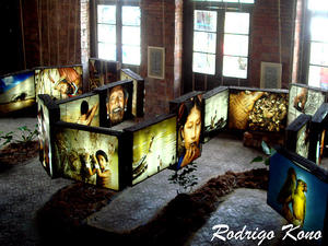
 Córrego Grande Ecologic Park - MAP GREAT STREAM OF ECOLOGICAL PARK In EnglishLocated in a neighborhood without a beach, with a total area of 21.3 hectares, the Big Creek Ecological Park has a diversified infrastructure to offer visitors an alternative in the leisure area in Florianopolis.The great attraction of the place are the trails. Bordered by native forest, they have signs, and identification of about 100 species of trees. As the plates have an important role... Córrego Grande Ecologic Park - MAP GREAT STREAM OF ECOLOGICAL PARK In EnglishLocated in a neighborhood without a beach, with a total area of 21.3 hectares, the Big Creek Ecological Park has a diversified infrastructure to offer visitors an alternative in the leisure area in Florianopolis.The great attraction of the place are the trails. Bordered by native forest, they have signs, and identification of about 100 species of trees. As the plates have an important role... |
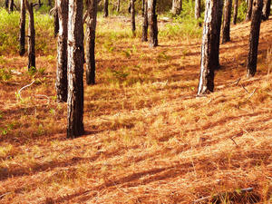 Estadual do Rio Vermelho Park - MAP
The Parque Estadual do Rio Vermelho (PAERVE) is located on the east coast of Santa Catarina, in Florianopolis, Santa Catarina State. Its boundaries are the district of St. John the Red River to the north, the Lagoa da Conceicao in the west, the beach east of Mozambique and the district of Barra da Lagoa south.
The park was created in order to keep samples of Rain Forest (Mata Atlantica), salt marsh vegetation to conserve, preserv... Estadual do Rio Vermelho Park - MAP
The Parque Estadual do Rio Vermelho (PAERVE) is located on the east coast of Santa Catarina, in Florianopolis, Santa Catarina State. Its boundaries are the district of St. John the Red River to the north, the Lagoa da Conceicao in the west, the beach east of Mozambique and the district of Barra da Lagoa south.
The park was created in order to keep samples of Rain Forest (Mata Atlantica), salt marsh vegetation to conserve, preserv... |
| Municipal da Galheta Park - MAP The park has an area of 1493ha, Galheta the beach, and its vegetation consists of grasses on top of hills, remnants of rainforest on the slopes and bushes in the area near the beach. The process of its creation began in the '80s, the movement for environmental preservation contrary to speculation that destroyed the greatest natural beauties of the island. The park also has a site with inscriptions, lithic workshops, grinding grooves and... |
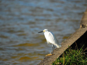 Municipal da Lagoa do Peri Park - MAP
Location: Southern Island of Santa Catarina.
Ecosystems: Rain Forest and Restinga.
Environments: All Stages of Ecological Succession of Rain Forest, Restinga, Wetland, Lagoon and beach.
Watershed: Watershed da Lagoa do Peri. Its main rivers are the Great Waterfall and Stream. The Peri Lagoon has an area of about 5 square kilometers and is situated approximately 2m above sea level.
Wild Fauna and Flora: It has im... Municipal da Lagoa do Peri Park - MAP
Location: Southern Island of Santa Catarina.
Ecosystems: Rain Forest and Restinga.
Environments: All Stages of Ecological Succession of Rain Forest, Restinga, Wetland, Lagoon and beach.
Watershed: Watershed da Lagoa do Peri. Its main rivers are the Great Waterfall and Stream. The Peri Lagoon has an area of about 5 square kilometers and is situated approximately 2m above sea level.
Wild Fauna and Flora: It has im... |
| Municipal da Lagoinha do Leste Park - MAP Beach, cliffs, pond, waterfall and native forest. These ingredients are all together in the East Pond, which hides its charm among the hills of the southern island of Santa Catarina. One of the last strongholds of Atlantic forest still preserved in Florianopolis, the Municipal Park of the East Pond, was created by statute in 1992 and comprises an area of 453 hectares of lush beauty.The best way to get to the East Pond is on foot. ... |
| Parque Estadual da Serra do Tabuleiro - MAP The largest unit of strictly protected areas of the state was created in 1975, based on studies of botanical and Robert Reitz Raulino Father Michael Klein, in order to protect the rich biodiversity of the region and the water sources that supply the cities of the Great Florianopolis and South State.The State Park of Serra tray takes up about 1% of the territory of Santa Catarina. It covers areas of the cities of Florianopolis, Palhoça,... |
| Parque Municipal das Dunas da Lagoa da Conceição - MAP 6
In the neighborhood of Lagoa da Conceição lies the Parque Municipal das Dunas da Lagoa da Conceição which was created in 1988. With its 463 hectares, the formation of fixed and semi-fixed dunes between Lacemakers Avenue and Joaquina beach is very popular among tourists.
The neighborhood gathers beaches, dunes, mountains and the largest lagoon of the island. It is said that san... |
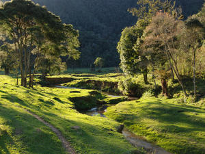 Parque Nacional da Serra do Itajaí - MAP
The park brings an area of 57,374 hectares and altitudes from 80 to 1039 meters, with many morrarias, trails, waterfalls and breathtaking falls in the Atlantic Forest, and contributes greatly to the preservation of fauna and flora that survive in this biome threatened and one of richest in biodiversity of our planet.
Installed on an extremely undulating topography, covered by lush Atlantic forest and home to nume... Parque Nacional da Serra do Itajaí - MAP
The park brings an area of 57,374 hectares and altitudes from 80 to 1039 meters, with many morrarias, trails, waterfalls and breathtaking falls in the Atlantic Forest, and contributes greatly to the preservation of fauna and flora that survive in this biome threatened and one of richest in biodiversity of our planet.
Installed on an extremely undulating topography, covered by lush Atlantic forest and home to nume... |
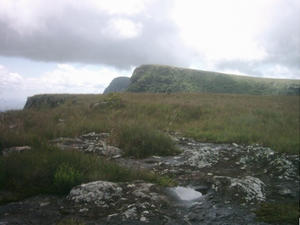 Parque Nacional da Serra Geral - MAP As a way of expanding the protected area of great and famous Brazilian canyons, was created in May 1992, the Parque Nacional da Serra Geral in Rio Grande do Sul and Santa Catarina.
The unit is like an extension of the National Park of Sierra Aparados, which form a larger conservation area.
The size of the area allows for greater effectiveness in combating the constant worrying and hunting activities that were being perform... Parque Nacional da Serra Geral - MAP As a way of expanding the protected area of great and famous Brazilian canyons, was created in May 1992, the Parque Nacional da Serra Geral in Rio Grande do Sul and Santa Catarina.
The unit is like an extension of the National Park of Sierra Aparados, which form a larger conservation area.
The size of the area allows for greater effectiveness in combating the constant worrying and hunting activities that were being perform... |
| Parque Nacional das Araucárias - MAP The National Park of Araucaria is a conservation unit located in the cities of Passos Maia Lumber and Bridge in the Brazilian state of Santa Catarina.
Created by Decree No. 293 of May 30, 2003, is located in the municipality of Santo Domingo River Basin Chapecó. The area of 612 acres is entirely covered by rain forest.
It is important to note the occurrence of two endangered species, the Araucaria angustifolia (Araucaria) and Di... |
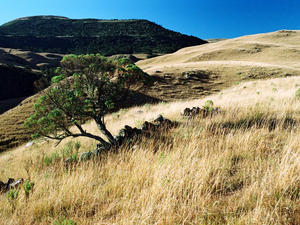 Parque Nacional de São Joaquim - MAP The National Park of San Joaquin is a conservation unit in Brazil and is located in the south, in Santa Catarina state near the town of San Joaquin, with a catchment area within the municipalities of Urubici and Bom Jardim da Serra. It was formed on July 6, 1961 by Decree No. 50,922. The total area of the park is 49,300 hectares. It is administered by the Chico Mendes Institute for Biodiversity Conservation (ICMBio).
In the northeast... Parque Nacional de São Joaquim - MAP The National Park of San Joaquin is a conservation unit in Brazil and is located in the south, in Santa Catarina state near the town of San Joaquin, with a catchment area within the municipalities of Urubici and Bom Jardim da Serra. It was formed on July 6, 1961 by Decree No. 50,922. The total area of the park is 49,300 hectares. It is administered by the Chico Mendes Institute for Biodiversity Conservation (ICMBio).
In the northeast... |
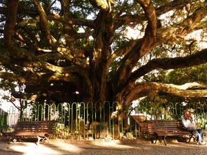 Praça XV de Novembro - MAP 6
The most important square in Florianópolis is a great place to stroll, relax and breathe fresh air. The Praça XV de Novembro (November XV square), or popularly known as "Figueira Square," houses the famous century-old fig tree, obviously.
The square has many attractions like its petit dessert style flooring reproducing a drawing with island folklore motifs, designed by artist Hassis, the Monumen... Praça XV de Novembro - MAP 6
The most important square in Florianópolis is a great place to stroll, relax and breathe fresh air. The Praça XV de Novembro (November XV square), or popularly known as "Figueira Square," houses the famous century-old fig tree, obviously.
The square has many attractions like its petit dessert style flooring reproducing a drawing with island folklore motifs, designed by artist Hassis, the Monumen... |
 Córrego Grande Ecologic Park - MAP GREAT STREAM OF ECOLOGICAL PARK In EnglishLocated in a neighborhood without a beach, with a total area of 21.3 hectares, the Big Creek Ecological Park has a diversified infrastructure to offer visitors an alternative in the leisure area in Florianopolis.The great attraction of the place are the trails. Bordered by native forest, they have signs, and identification of about 100 species of trees. As the plates have an important role...
 Estadual do Rio Vermelho Park - MAP
The Parque Estadual do Rio Vermelho (PAERVE) is located on the east coast of Santa Catarina, in Florianopolis, Santa Catarina State. Its boundaries are the district of St. John the Red River to the north, the Lagoa da Conceicao in the west, the beach east of Mozambique and the district of Barra da Lagoa south.
The park was created in order to keep samples of Rain Forest (Mata Atlantica), salt marsh vegetation to conserve, preserv...
 Municipal da Lagoa do Peri Park - MAP
Location: Southern Island of Santa Catarina.
Ecosystems: Rain Forest and Restinga.
Environments: All Stages of Ecological Succession of Rain Forest, Restinga, Wetland, Lagoon and beach.
Watershed: Watershed da Lagoa do Peri. Its main rivers are the Great Waterfall and Stream. The Peri Lagoon has an area of about 5 square kilometers and is situated approximately 2m above sea level.
Wild Fauna and Flora: It has im...
 Parque Nacional da Serra do Itajaí - MAP
The park brings an area of 57,374 hectares and altitudes from 80 to 1039 meters, with many morrarias, trails, waterfalls and breathtaking falls in the Atlantic Forest, and contributes greatly to the preservation of fauna and flora that survive in this biome threatened and one of richest in biodiversity of our planet.
Installed on an extremely undulating topography, covered by lush Atlantic forest and home to nume...
 Parque Nacional da Serra Geral - MAP As a way of expanding the protected area of great and famous Brazilian canyons, was created in May 1992, the Parque Nacional da Serra Geral in Rio Grande do Sul and Santa Catarina.
The unit is like an extension of the National Park of Sierra Aparados, which form a larger conservation area.
The size of the area allows for greater effectiveness in combating the constant worrying and hunting activities that were being perform...
 Parque Nacional de São Joaquim - MAP The National Park of San Joaquin is a conservation unit in Brazil and is located in the south, in Santa Catarina state near the town of San Joaquin, with a catchment area within the municipalities of Urubici and Bom Jardim da Serra. It was formed on July 6, 1961 by Decree No. 50,922. The total area of the park is 49,300 hectares. It is administered by the Chico Mendes Institute for Biodiversity Conservation (ICMBio).
In the northeast...
 Praça XV de Novembro - MAP 6
The most important square in Florianópolis is a great place to stroll, relax and breathe fresh air. The Praça XV de Novembro (November XV square), or popularly known as "Figueira Square," houses the famous century-old fig tree, obviously.
The square has many attractions like its petit dessert style flooring reproducing a drawing with island folklore motifs, designed by artist Hassis, the Monumen...