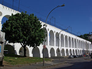
 Arcos da Lapa - MAP Birthplace of the famously bohemian Rio, also reveals a neighborhood
of the richest architectural city
Only one neighborhood in Rio de Janeiro can aggregate various musical events without dazzling genres and artists. The site is Lapa, downtown, where is the flagship project of the Arcos da Lapa. Stage for the poetry of the lyrics of the samba, the chords sound the northeast and the modernity of electronic music, all live in perfect ... Arcos da Lapa - MAP Birthplace of the famously bohemian Rio, also reveals a neighborhood
of the richest architectural city
Only one neighborhood in Rio de Janeiro can aggregate various musical events without dazzling genres and artists. The site is Lapa, downtown, where is the flagship project of the Arcos da Lapa. Stage for the poetry of the lyrics of the samba, the chords sound the northeast and the modernity of electronic music, all live in perfect ... |
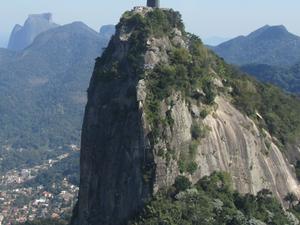 Christ Redeemer - MAP
One of the most famous land marks in all of South America, the Christ Redeemer is a statue of Jesus Christ in Rio de Janeiro, which located at the peak of the 2300 foot high Cocovado Mountain and over looks all of Rio de Janeiro. The Christ Redeemer is considered the second largest Art Deco statue in the world, standing 130 feet tall. The statue was originally constructed between 1922 and 1931 and is now one of the lar... Christ Redeemer - MAP
One of the most famous land marks in all of South America, the Christ Redeemer is a statue of Jesus Christ in Rio de Janeiro, which located at the peak of the 2300 foot high Cocovado Mountain and over looks all of Rio de Janeiro. The Christ Redeemer is considered the second largest Art Deco statue in the world, standing 130 feet tall. The statue was originally constructed between 1922 and 1931 and is now one of the lar... |
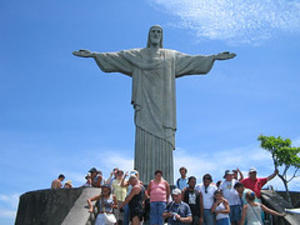 Corcovado - MAP 2 The funicular train up costs R$36 (students pay 50% - R$18 but are usually requested to prove showing some ID or document) for a round trip up to Cristo Redentor, and it is definitely worth the view. The queue for the train, in Cosme Velho, can get rather long; you purchase a ticket for a particular departure time (that day only). Try going when the morning coach parties have already passed through, i.e. when most tourists are having th... Corcovado - MAP 2 The funicular train up costs R$36 (students pay 50% - R$18 but are usually requested to prove showing some ID or document) for a round trip up to Cristo Redentor, and it is definitely worth the view. The queue for the train, in Cosme Velho, can get rather long; you purchase a ticket for a particular departure time (that day only). Try going when the morning coach parties have already passed through, i.e. when most tourists are having th... |
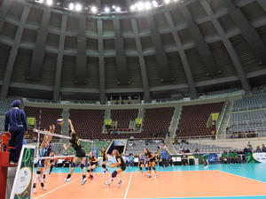 Gilberto Cardoso Gym - Maracanãzinho - MAP 3 Maracanãzinho was opened in 1954 at the Maracana (11618) complex, with capacity to accommodate 13,613 people and a multipurpose court for volleyball, basketball, handball and futsal. In honor of the former president of the Club de Regatas do Flamengo, was named Gilberto Cardoso.
Among the many international sporting events held there, the highlight was the Men's Basketball World Championship in 1963 and Female Volleyball World Champ... Gilberto Cardoso Gym - Maracanãzinho - MAP 3 Maracanãzinho was opened in 1954 at the Maracana (11618) complex, with capacity to accommodate 13,613 people and a multipurpose court for volleyball, basketball, handball and futsal. In honor of the former president of the Club de Regatas do Flamengo, was named Gilberto Cardoso.
Among the many international sporting events held there, the highlight was the Men's Basketball World Championship in 1963 and Female Volleyball World Champ... |
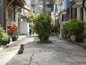 Ipanema - MAP Perhaps even more irresistible than the muse who inspired the song "Girl from Ipanema, " which immortalized it. Ipanema is certainly a famous meeting point of Rio de Janeiro.
Sophisticated and an intense nightlife, the neighborhood is a happy gathering of beach, bars and shops. Permanent attraction during the day, the beach also receives a large number of visitors during the night. These are people who walk, play sports, fraternize k... Ipanema - MAP Perhaps even more irresistible than the muse who inspired the song "Girl from Ipanema, " which immortalized it. Ipanema is certainly a famous meeting point of Rio de Janeiro.
Sophisticated and an intense nightlife, the neighborhood is a happy gathering of beach, bars and shops. Permanent attraction during the day, the beach also receives a large number of visitors during the night. These are people who walk, play sports, fraternize k... |
| Lapa - Lapa: Rio Cradle of famous bohemian neighborhood, it also reveals one of the richest architectural city.Only one neighborhood in Rio de Janeiro can aggregate various musical events without dazzling genres and artists. The site is Lapa, downtown, where is the flagship project of the Arcos da Lapa. Stage for the poetry of the lyrics of the samba, the chords sound the northeast and the modernity of electronic music, all live in perfect har... |
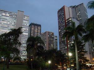 Largo da Carioca - MAP The history of the Largo da Carioca is closely linked to the Convent of Santo Antonio. The Convent had its origins in a small chapel, which stood on the banks of the pond that was occupied in 1592 by Franciscan friars, Fray Antonio Martyrs and Frei Antonio das Chagas. However, its construction only began in June 1608 under the presidency of Frei Vicente do Salvador and in 1615 opened a part of the Convent and Church of Santo Antonio, wh... Largo da Carioca - MAP The history of the Largo da Carioca is closely linked to the Convent of Santo Antonio. The Convent had its origins in a small chapel, which stood on the banks of the pond that was occupied in 1592 by Franciscan friars, Fray Antonio Martyrs and Frei Antonio das Chagas. However, its construction only began in June 1608 under the presidency of Frei Vicente do Salvador and in 1615 opened a part of the Convent and Church of Santo Antonio, wh... |
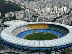 Maracanã Stadium - MAP 3 Opened to receive the 1950 World Cup, Maracana's second most visited by tourists and residents in Rio de Janeiro. Now under construction, the stadium continues to open doors. The new visitation was opened on March 4, 2011 and is made by the Tower of Glass. Located in the north of the city, access to the complex - which also includes the Maracanazinho, the Athletics Track Celio de Barros and the Julio Delamare Aquatic Park - is easy. You... Maracanã Stadium - MAP 3 Opened to receive the 1950 World Cup, Maracana's second most visited by tourists and residents in Rio de Janeiro. Now under construction, the stadium continues to open doors. The new visitation was opened on March 4, 2011 and is made by the Tower of Glass. Located in the north of the city, access to the complex - which also includes the Maracanazinho, the Athletics Track Celio de Barros and the Julio Delamare Aquatic Park - is easy. You... |
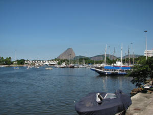 Marina da Glória - MAP Gloria Marina
Virtually in the center of town between the Santos Dumont Airport and the Monument of World War II in the Park Eduardo Gomes - Landfill of Glory, the Marina is a port for sailing athletes and visitors to the city.
And those who see it from afar has the impression of looking at a painting, a work of art from nature.
It occupies an area of 105,000 sqm and has floating docks and piers and an infrastructure to suppor... Marina da Glória - MAP Gloria Marina
Virtually in the center of town between the Santos Dumont Airport and the Monument of World War II in the Park Eduardo Gomes - Landfill of Glory, the Marina is a port for sailing athletes and visitors to the city.
And those who see it from afar has the impression of looking at a painting, a work of art from nature.
It occupies an area of 105,000 sqm and has floating docks and piers and an infrastructure to suppor... |
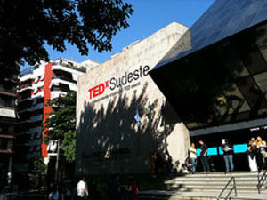 Planetário da Gávea - MAP The Planetarium Foundation City of Rio de Janeiro was established in 1970 with the aim of spreading the astronomy and related sciences and develop cultural projects. The institution promotes activities such as summit meetings, interactive experiments and observations to the telescope, courses, lectures, exhibitions, summer camps, in addition to projects like "Music in the Stars" and "Sleeping with the Stars. "The Planetarium has two sum... Planetário da Gávea - MAP The Planetarium Foundation City of Rio de Janeiro was established in 1970 with the aim of spreading the astronomy and related sciences and develop cultural projects. The institution promotes activities such as summit meetings, interactive experiments and observations to the telescope, courses, lectures, exhibitions, summer camps, in addition to projects like "Music in the Stars" and "Sleeping with the Stars. "The Planetarium has two sum... |
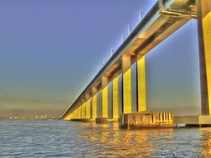 Ponte Rio Niterói - MAP Inaugurated in 1974, Ponte Presidente Costa e Silva, better known as Ponte Rio - Niterói, is one of the largest bridges in the world, with its 13 km long and up to 72 feet tall in the stretch of the central span. It is the capital's main link with Niteroi and the State of Rio de Janeiro, especially the tourist hub of the Lake, also known as the Costa del Sol.Com 145mil average flow of vehicles per day, carrying more than 450,000 people... Ponte Rio Niterói - MAP Inaugurated in 1974, Ponte Presidente Costa e Silva, better known as Ponte Rio - Niterói, is one of the largest bridges in the world, with its 13 km long and up to 72 feet tall in the stretch of the central span. It is the capital's main link with Niteroi and the State of Rio de Janeiro, especially the tourist hub of the Lake, also known as the Costa del Sol.Com 145mil average flow of vehicles per day, carrying more than 450,000 people... |
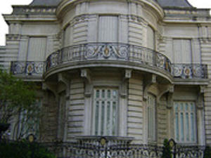 Presépio da Casa de Arte e Cultura Julieta de Serpa - MAP December until Jan. 6
Nativity of the House of Art and Culture Julieta de Serpa
The traditional nativity scene brings together 3,000 pieces, Italian and French, representing the birth of Christ. The Holy Family is represented in a typical environment of Naples in the midst of the fairs of vegetables, fruits and fish. The main figures - the Infant Jesus, St. Joseph, Mary, the Three Magi, the angels announced the birth of the Messi... Presépio da Casa de Arte e Cultura Julieta de Serpa - MAP December until Jan. 6
Nativity of the House of Art and Culture Julieta de Serpa
The traditional nativity scene brings together 3,000 pieces, Italian and French, representing the birth of Christ. The Holy Family is represented in a typical environment of Naples in the midst of the fairs of vegetables, fruits and fish. The main figures - the Infant Jesus, St. Joseph, Mary, the Three Magi, the angels announced the birth of the Messi... |
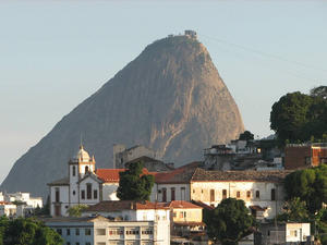 Santa Teresa Neighborhood - MAP
The neighborhood of Santa Teresa was born outside of a convent on Morro do Desterro, Rio de Janeiro in the early 18th century. The district occupies a hilltop in the heart of the city and seems to have stopped in time, keeping dozens of years preserved features of Old Rio and a story around every corner. Writers and artists have always been attracted to Santa Teresa, seduced by its charm and its architectural and cultura... Santa Teresa Neighborhood - MAP
The neighborhood of Santa Teresa was born outside of a convent on Morro do Desterro, Rio de Janeiro in the early 18th century. The district occupies a hilltop in the heart of the city and seems to have stopped in time, keeping dozens of years preserved features of Old Rio and a story around every corner. Writers and artists have always been attracted to Santa Teresa, seduced by its charm and its architectural and cultura... |
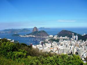 Sugar Loaf - MAP Pão de Açúcar - The Sugar Loaf mountains (one taller, the other shorter), Brazil's top landmark, with a two-stage aerial tramway to the top; a definite must see. A ticket is R$44. There is also an unsigned trail leading to the second station where you can pay only R$22 to reach the top. Ask locals for directions. The buses number 511, 512, 591 and 592 and the subway buses from Botafogo bring you to the base station. Do not make the m... Sugar Loaf - MAP Pão de Açúcar - The Sugar Loaf mountains (one taller, the other shorter), Brazil's top landmark, with a two-stage aerial tramway to the top; a definite must see. A ticket is R$44. There is also an unsigned trail leading to the second station where you can pay only R$22 to reach the top. Ask locals for directions. The buses number 511, 512, 591 and 592 and the subway buses from Botafogo bring you to the base station. Do not make the m... |
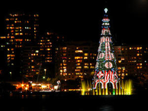 The Christmas Tree Lagoon - MAP
one of the symbols of Rio de Janeiro at the end of the year, was inaugurated on Saturday night (5). View photo gallery The traditional Christmas tree, which since 1996 graces the Lagoon, has 150 wreaths and nearly 3 million micro bulbs in this year. According to organizers, it is 85 meters high, equivalent to a building of 28 floors. Also, the tree entered the Guinness Book as the largest floating Christmas tree in the... The Christmas Tree Lagoon - MAP
one of the symbols of Rio de Janeiro at the end of the year, was inaugurated on Saturday night (5). View photo gallery The traditional Christmas tree, which since 1996 graces the Lagoon, has 150 wreaths and nearly 3 million micro bulbs in this year. According to organizers, it is 85 meters high, equivalent to a building of 28 floors. Also, the tree entered the Guinness Book as the largest floating Christmas tree in the... |
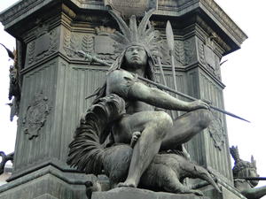 Tiradentes Square in Rio - MAP In the center of the square is the oldest public statue in Rio de Janeiro. Inaugurated by Dom Pedro II in 1862, Dom Pedro I honor her as a symbol of the strength of the Empire. On a horse, and surrounded by indigenous allegories, the Emperor has in hand the "Manifesto to Friendly Nations," he announced to the world the independence of Brazil. Surrounding the square, are two of the most important theaters in Rio - Carlos Gomes, 1905, and... Tiradentes Square in Rio - MAP In the center of the square is the oldest public statue in Rio de Janeiro. Inaugurated by Dom Pedro II in 1862, Dom Pedro I honor her as a symbol of the strength of the Empire. On a horse, and surrounded by indigenous allegories, the Emperor has in hand the "Manifesto to Friendly Nations," he announced to the world the independence of Brazil. Surrounding the square, are two of the most important theaters in Rio - Carlos Gomes, 1905, and... |
 Arcos da Lapa - MAP Birthplace of the famously bohemian Rio, also reveals a neighborhood
of the richest architectural city
Only one neighborhood in Rio de Janeiro can aggregate various musical events without dazzling genres and artists. The site is Lapa, downtown, where is the flagship project of the Arcos da Lapa. Stage for the poetry of the lyrics of the samba, the chords sound the northeast and the modernity of electronic music, all live in perfect ...
 Christ Redeemer - MAP
One of the most famous land marks in all of South America, the Christ Redeemer is a statue of Jesus Christ in Rio de Janeiro, which located at the peak of the 2300 foot high Cocovado Mountain and over looks all of Rio de Janeiro. The Christ Redeemer is considered the second largest Art Deco statue in the world, standing 130 feet tall. The statue was originally constructed between 1922 and 1931 and is now one of the lar...
 Corcovado - MAP 2 The funicular train up costs R$36 (students pay 50% - R$18 but are usually requested to prove showing some ID or document) for a round trip up to Cristo Redentor, and it is definitely worth the view. The queue for the train, in Cosme Velho, can get rather long; you purchase a ticket for a particular departure time (that day only). Try going when the morning coach parties have already passed through, i.e. when most tourists are having th...
 Gilberto Cardoso Gym - Maracanãzinho - MAP 3 Maracanãzinho was opened in 1954 at the Maracana (11618) complex, with capacity to accommodate 13,613 people and a multipurpose court for volleyball, basketball, handball and futsal. In honor of the former president of the Club de Regatas do Flamengo, was named Gilberto Cardoso.
Among the many international sporting events held there, the highlight was the Men's Basketball World Championship in 1963 and Female Volleyball World Champ...
 Ipanema - MAP Perhaps even more irresistible than the muse who inspired the song "Girl from Ipanema, " which immortalized it. Ipanema is certainly a famous meeting point of Rio de Janeiro.
Sophisticated and an intense nightlife, the neighborhood is a happy gathering of beach, bars and shops. Permanent attraction during the day, the beach also receives a large number of visitors during the night. These are people who walk, play sports, fraternize k...
 Largo da Carioca - MAP The history of the Largo da Carioca is closely linked to the Convent of Santo Antonio. The Convent had its origins in a small chapel, which stood on the banks of the pond that was occupied in 1592 by Franciscan friars, Fray Antonio Martyrs and Frei Antonio das Chagas. However, its construction only began in June 1608 under the presidency of Frei Vicente do Salvador and in 1615 opened a part of the Convent and Church of Santo Antonio, wh...
 Maracanã Stadium - MAP 3 Opened to receive the 1950 World Cup, Maracana's second most visited by tourists and residents in Rio de Janeiro. Now under construction, the stadium continues to open doors. The new visitation was opened on March 4, 2011 and is made by the Tower of Glass. Located in the north of the city, access to the complex - which also includes the Maracanazinho, the Athletics Track Celio de Barros and the Julio Delamare Aquatic Park - is easy. You...
 Marina da Glória - MAP Gloria Marina
Virtually in the center of town between the Santos Dumont Airport and the Monument of World War II in the Park Eduardo Gomes - Landfill of Glory, the Marina is a port for sailing athletes and visitors to the city.
And those who see it from afar has the impression of looking at a painting, a work of art from nature.
It occupies an area of 105,000 sqm and has floating docks and piers and an infrastructure to suppor...
 Planetário da Gávea - MAP The Planetarium Foundation City of Rio de Janeiro was established in 1970 with the aim of spreading the astronomy and related sciences and develop cultural projects. The institution promotes activities such as summit meetings, interactive experiments and observations to the telescope, courses, lectures, exhibitions, summer camps, in addition to projects like "Music in the Stars" and "Sleeping with the Stars. "The Planetarium has two sum...
 Ponte Rio Niterói - MAP Inaugurated in 1974, Ponte Presidente Costa e Silva, better known as Ponte Rio - Niterói, is one of the largest bridges in the world, with its 13 km long and up to 72 feet tall in the stretch of the central span. It is the capital's main link with Niteroi and the State of Rio de Janeiro, especially the tourist hub of the Lake, also known as the Costa del Sol.Com 145mil average flow of vehicles per day, carrying more than 450,000 people...
 Presépio da Casa de Arte e Cultura Julieta de Serpa - MAP December until Jan. 6
Nativity of the House of Art and Culture Julieta de Serpa
The traditional nativity scene brings together 3,000 pieces, Italian and French, representing the birth of Christ. The Holy Family is represented in a typical environment of Naples in the midst of the fairs of vegetables, fruits and fish. The main figures - the Infant Jesus, St. Joseph, Mary, the Three Magi, the angels announced the birth of the Messi...
 Santa Teresa Neighborhood - MAP
The neighborhood of Santa Teresa was born outside of a convent on Morro do Desterro, Rio de Janeiro in the early 18th century. The district occupies a hilltop in the heart of the city and seems to have stopped in time, keeping dozens of years preserved features of Old Rio and a story around every corner. Writers and artists have always been attracted to Santa Teresa, seduced by its charm and its architectural and cultura...
 Sugar Loaf - MAP Pão de Açúcar - The Sugar Loaf mountains (one taller, the other shorter), Brazil's top landmark, with a two-stage aerial tramway to the top; a definite must see. A ticket is R$44. There is also an unsigned trail leading to the second station where you can pay only R$22 to reach the top. Ask locals for directions. The buses number 511, 512, 591 and 592 and the subway buses from Botafogo bring you to the base station. Do not make the m...
 The Christmas Tree Lagoon - MAP
one of the symbols of Rio de Janeiro at the end of the year, was inaugurated on Saturday night (5). View photo gallery The traditional Christmas tree, which since 1996 graces the Lagoon, has 150 wreaths and nearly 3 million micro bulbs in this year. According to organizers, it is 85 meters high, equivalent to a building of 28 floors. Also, the tree entered the Guinness Book as the largest floating Christmas tree in the...
 Tiradentes Square in Rio - MAP In the center of the square is the oldest public statue in Rio de Janeiro. Inaugurated by Dom Pedro II in 1862, Dom Pedro I honor her as a symbol of the strength of the Empire. On a horse, and surrounded by indigenous allegories, the Emperor has in hand the "Manifesto to Friendly Nations," he announced to the world the independence of Brazil. Surrounding the square, are two of the most important theaters in Rio - Carlos Gomes, 1905, and...