 Brasilia Botanical Gardens - MAP It was founded in March 1985 and since then has been through many reformation works to comply with its original philosophical – to be a sample of the “cerrado” (the dry pasture vegetation typical of Central Brazil) landscape -, and technical requirements – to become a space dedicated to research, environmental education and leisure for the city’s population. It offers to visitors the typical vegetation of the “cerrado” are... Brasilia Botanical Gardens - MAP It was founded in March 1985 and since then has been through many reformation works to comply with its original philosophical – to be a sample of the “cerrado” (the dry pasture vegetation typical of Central Brazil) landscape -, and technical requirements – to become a space dedicated to research, environmental education and leisure for the city’s population. It offers to visitors the typical vegetation of the “cerrado” are... |
| Cachoeira da Saia Velha - MAP Waterfalls, pools, pit 30 meters deep for scuba diving and fauna and flora of the cerrado are part of the complex of the Old Exit, a club that has, in addition to the resort. The structure for the visitor also has a mini zoo, nursery, sports, camping and barbecues.
Location: Access the BR 040, from the South Exit of Sundeck city until the Monument.
Telephone: (61) 3502-6065.
http://www.brasil.gov.br/brasilia/conteudo/guia-t... |
| Cachoeiras do Ribeirão 2 Irmãos - This is a set of 30 wells and waterfalls, located in the creek, Two Brothers, in the APA Cafuringa, north of the Federal District. It is currently in private ownership, known as the Imperial Treasury, where he accepts visitors in groups previously scheduled.It lies on the edge of the plateau, vegetation has relatively well preserved, including riverine forests typical of the cerrado. One of the most beautiful spots of the plateau of the... |
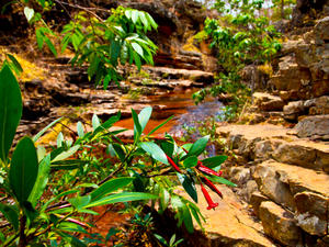 Imperial Plateau Park - MAP 6 Chapada Imperial is the largest private environmental reservation in the Federal District, with 4,800 hectares.
It is located 50 km from Brasília in the Cafuringa Environmental Protection Area. The reservation, preserved since 1986, has waterfalls, natural pools and some caves over a billion years old.
Touring the Dois Irmãos creek, which runs along the canal formed by cracks downhill, is special. In the region it is possible ... Imperial Plateau Park - MAP 6 Chapada Imperial is the largest private environmental reservation in the Federal District, with 4,800 hectares.
It is located 50 km from Brasília in the Cafuringa Environmental Protection Area. The reservation, preserved since 1986, has waterfalls, natural pools and some caves over a billion years old.
Touring the Dois Irmãos creek, which runs along the canal formed by cracks downhill, is special. In the region it is possible ... |
| Lagoa Bonita - MAP One of the most beautiful natural lakes in the Federal District, is located in the area that housed the Mission Explorers Cruls. In 1892, the group examined the area and established the territorial limits of the future of the Federal Capital. With 5 km long and almost 800 m wide, the Bonita Pond is one of many refuges where wild animals of the Brazilian savannah.
Location: North Exit, take the BR-020 until Planaltina. After the entra... |
| Mumunhas Waterfall - MAP Less than 50 km of the Pilot Plan is one of those places Mumunhas unforgettable. With six waterfalls, pools and natural showers, the region could be exploited by two tracks. The shortest of two hours, and one longer, 4 hours, can be covered with guidance from guides.
On Sundays, the visitor has the option of a hike to observe birds in the cerrado. Mumunhas is a mystical place and suitable for those who want to relax and meditate, and... |
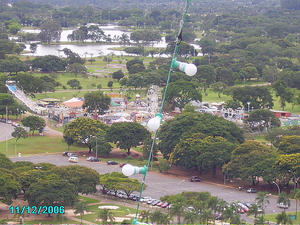 Nicolandia Center Park - MAP 8 An amusement park for the whole family with typical rides, foods and games for children. Over more than three decades of history by participating in several generations of Brasilia residents, Nicolândia Center Park is considered an icon of the city of Brasilia and reference of fun in the Midwest Region as having one of their main focuses for social action and education. The brand Nicolândia has gone beyond the world of entertainment ... Nicolandia Center Park - MAP 8 An amusement park for the whole family with typical rides, foods and games for children. Over more than three decades of history by participating in several generations of Brasilia residents, Nicolândia Center Park is considered an icon of the city of Brasilia and reference of fun in the Midwest Region as having one of their main focuses for social action and education. The brand Nicolândia has gone beyond the world of entertainment ... |
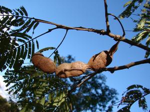 Olhos D'Água Park - MAP Parque Olhos D'Agua is a small oasis in the middle of the North Wing, the Pilot Plan. The area has hiking trails surrounded by native vegetation and animals of the savannah. The Frog Pond is one of the main attractions of the trail. The playground, fitness equipment and space for environmental education activities complete the structure. Location: North Wing (entrance at 414 block North) Visiting hours: Daily from 6am to 20h. Phone: (61... Olhos D'Água Park - MAP Parque Olhos D'Agua is a small oasis in the middle of the North Wing, the Pilot Plan. The area has hiking trails surrounded by native vegetation and animals of the savannah. The Frog Pond is one of the main attractions of the trail. The playground, fitness equipment and space for environmental education activities complete the structure. Location: North Wing (entrance at 414 block North) Visiting hours: Daily from 6am to 20h. Phone: (61... |
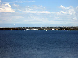 Paranoá Lake - MAP 6 Paranoá Lake and Dam
Built in order to increase the humidity of the region where the Federal Capital is located, Paranoá Lake also offers leisure options for residents and tourists.
For example, nautical sports such as water ski, wakeboard, sailing and rowing.
Diving can also be practiced and one of the main attractions is Vila Amaury, an old village that is submerged in the lake.
This is where the first construction worke... Paranoá Lake - MAP 6 Paranoá Lake and Dam
Built in order to increase the humidity of the region where the Federal Capital is located, Paranoá Lake also offers leisure options for residents and tourists.
For example, nautical sports such as water ski, wakeboard, sailing and rowing.
Diving can also be practiced and one of the main attractions is Vila Amaury, an old village that is submerged in the lake.
This is where the first construction worke... |
| Parque Ecológico de Águas Claras - MAP 6 Clearwater Park
One of the biggest and most important cities in the Federal District, Águas Claras has a beautiful park for the leisure of residents and tourists. The place preserves the riparian woods on the Águas Claras creek, besides a fruit garden, exotic plants and grasslands.
There are two artificial lakes in the park and several animals such as monkeys, toucans, sabiás-laranjeira (thrushes), bem-te-vis, white and black an... |
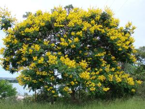 Parque Ecológico Dom Bosco - MAP The park is located on the shores of Lake Paranoa in South Lake, Federal Distito. It has an area of 131 hectares, with typical fauna and flora of the cerrado. Offers trail about 2 km, with a degree of difficulty, the rugged terrain. It also has a proper place for swimming in the lake. The site, has a panoramic view of the central area of Brasilia and of the presidential palace.
Don Bosco Chapel houses the monument in honor of Father ... Parque Ecológico Dom Bosco - MAP The park is located on the shores of Lake Paranoa in South Lake, Federal Distito. It has an area of 131 hectares, with typical fauna and flora of the cerrado. Offers trail about 2 km, with a degree of difficulty, the rugged terrain. It also has a proper place for swimming in the lake. The site, has a panoramic view of the central area of Brasilia and of the presidential palace.
Don Bosco Chapel houses the monument in honor of Father ... |
| Parque Ecológico e Vivencial do Recanto das Emas - MAP Created in 1996 through the 1188 Act, the Ecological Park of the Corner of Experiential and Emus have your area bounded by Finchley Village of Peace, including the headwaters of the stream Monjolo in the Administrative Region of the Corner of Emas (RA-XV). Part of the park is close to the Quadra 508 to 511 of the Corner as a reference point, the Sewage Treatment Station of Caesb. On the other hand, access to the park is by Núcleo Rural... |
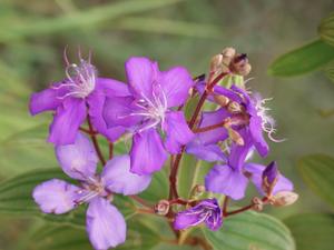 Parque Nacional de Brasilia - MAP 6 Brasília National Park – Mineral Water has two swimming pools of running mineral water which are the main attractions of Parque Nacional de Brasília, better known as Água Mineral.
Soon after the inauguration of Brasília, an agreement between the Ministry of Agriculture and Companhia Urbanizadora da Nova Capital (Novacap) allowed for the creation of a nursery, where today part of Parque Nacional is, dedicated to the city’s a... Parque Nacional de Brasilia - MAP 6 Brasília National Park – Mineral Water has two swimming pools of running mineral water which are the main attractions of Parque Nacional de Brasília, better known as Água Mineral.
Soon after the inauguration of Brasília, an agreement between the Ministry of Agriculture and Companhia Urbanizadora da Nova Capital (Novacap) allowed for the creation of a nursery, where today part of Parque Nacional is, dedicated to the city’s a... |
| Pipiripau Park - MAP With approximately 88 hectares, the Ecological Park and Experiential Pipiripau Waterfall, located in Planaltina, has great beauty. On the banks of Ribeirão Pipiripau, and near the Great Stream Capon its tributary, the region has for the practice of local leisure activities. Rio Pipiripau form wells and streams within the park. Known for a long time, the site receives visits from people all over the DF. Once proven that the waters are c... |
| Salto do Tororó - MAP A waterfall up close to Brasilia, the Leap of Tororo is 18 feet high with rocky river bed and a little bumpy. The landscape is an invitation to adventure sports, especially the rappel. The trails to reach the waterfall, covered by quartzite rocks are a popular activity.
Location: From SR-23 South Lake, followed by the DF-140 toward Unai, Minas Gerais, for another 5 miles and turn right on dirt road. 35 km far from Brasilia
http:... |
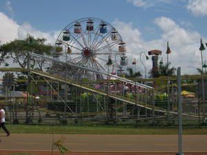 Sarah Kubitschek City Park - MAP Sarah Kubitschek City Park has three main paved trails, roughly 2, 4 and 6 miles long, great for a leisurely walk or jog. The park also features restaurants, an amphitheaer, playgrounds, bbq areas and an equestrian center.
Located inside the city’s Pilot Plan, the “Parque da Cidade” (City Park”), extends over four million square meters. It includes landscape works of Burle Marx, and wall t... Sarah Kubitschek City Park - MAP Sarah Kubitschek City Park has three main paved trails, roughly 2, 4 and 6 miles long, great for a leisurely walk or jog. The park also features restaurants, an amphitheaer, playgrounds, bbq areas and an equestrian center.
Located inside the city’s Pilot Plan, the “Parque da Cidade” (City Park”), extends over four million square meters. It includes landscape works of Burle Marx, and wall t... |
| Waterfall Cave and the Salt River - MAP The river forms several falls, ranging from 6 to 12 feet high, at an average distance of 100 meters. Form also showers and pools with a water volume, and has a medium-sized trees on the banks of the riverbed. The cave has several galleries and rooms covered with stalactites and stalagmites of striking colors, and a large hall with about 15 meters wide and 30 deep. Brazlândia is located near the 68 km of the Pilot Plan. Access is by DF-... |
 Brasilia Botanical Gardens - MAP It was founded in March 1985 and since then has been through many reformation works to comply with its original philosophical – to be a sample of the “cerrado” (the dry pasture vegetation typical of Central Brazil) landscape -, and technical requirements – to become a space dedicated to research, environmental education and leisure for the city’s population. It offers to visitors the typical vegetation of the “cerrado” are...
 Imperial Plateau Park - MAP 6 Chapada Imperial is the largest private environmental reservation in the Federal District, with 4,800 hectares.
It is located 50 km from Brasília in the Cafuringa Environmental Protection Area. The reservation, preserved since 1986, has waterfalls, natural pools and some caves over a billion years old.
Touring the Dois Irmãos creek, which runs along the canal formed by cracks downhill, is special. In the region it is possible ...
 Nicolandia Center Park - MAP 8 An amusement park for the whole family with typical rides, foods and games for children. Over more than three decades of history by participating in several generations of Brasilia residents, Nicolândia Center Park is considered an icon of the city of Brasilia and reference of fun in the Midwest Region as having one of their main focuses for social action and education. The brand Nicolândia has gone beyond the world of entertainment ...
 Olhos D'Água Park - MAP Parque Olhos D'Agua is a small oasis in the middle of the North Wing, the Pilot Plan. The area has hiking trails surrounded by native vegetation and animals of the savannah. The Frog Pond is one of the main attractions of the trail. The playground, fitness equipment and space for environmental education activities complete the structure. Location: North Wing (entrance at 414 block North) Visiting hours: Daily from 6am to 20h. Phone: (61...
 Paranoá Lake - MAP 6 Paranoá Lake and Dam
Built in order to increase the humidity of the region where the Federal Capital is located, Paranoá Lake also offers leisure options for residents and tourists.
For example, nautical sports such as water ski, wakeboard, sailing and rowing.
Diving can also be practiced and one of the main attractions is Vila Amaury, an old village that is submerged in the lake.
This is where the first construction worke...
 Parque Ecológico Dom Bosco - MAP The park is located on the shores of Lake Paranoa in South Lake, Federal Distito. It has an area of 131 hectares, with typical fauna and flora of the cerrado. Offers trail about 2 km, with a degree of difficulty, the rugged terrain. It also has a proper place for swimming in the lake. The site, has a panoramic view of the central area of Brasilia and of the presidential palace.
Don Bosco Chapel houses the monument in honor of Father ...
 Parque Nacional de Brasilia - MAP 6 Brasília National Park – Mineral Water has two swimming pools of running mineral water which are the main attractions of Parque Nacional de Brasília, better known as Água Mineral.
Soon after the inauguration of Brasília, an agreement between the Ministry of Agriculture and Companhia Urbanizadora da Nova Capital (Novacap) allowed for the creation of a nursery, where today part of Parque Nacional is, dedicated to the city’s a...
 Sarah Kubitschek City Park - MAP Sarah Kubitschek City Park has three main paved trails, roughly 2, 4 and 6 miles long, great for a leisurely walk or jog. The park also features restaurants, an amphitheaer, playgrounds, bbq areas and an equestrian center.
Located inside the city’s Pilot Plan, the “Parque da Cidade” (City Park”), extends over four million square meters. It includes landscape works of Burle Marx, and wall t...