Belém Travel Information
Beaches in Belém
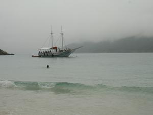
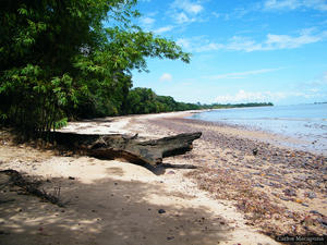
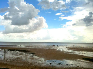
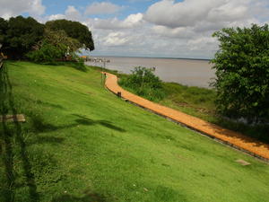
Located on the banks of the Bay of Guajará, Belém is formed by a set of estuaries at the mouth of the Amazon river. The location of the city gives it a number of beaches along both the coast and along the many islands and river banks of the famous Amazon river. The ocean is nearly three hours away from Belém, but when you're searching for some amazing beaches, and time is of no consequence, you'll find them along the coastal regions. Along with the beaches on the coastal regions and the immediate areas surrounding Belém, consider going up the Amazon river on a boat tour for a few days, where you'll have a chance to visit many great resting areas, and places to both bath and enjoy the sun. |
| Amor Beach - MAP 3 Praia do Amor (Love Beach) is a cove of pale sand with fresh water. There are two streams on the extent of Praia do Amor. Its edge has several stalls serving snacks such as fish, shrimps and crabs. Outeiro, satellite city of Belém, is home to the Love Beach where there are some hotels. |
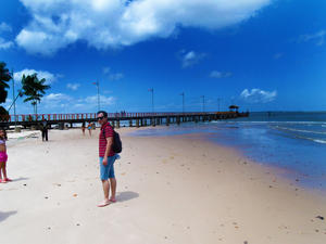 Areião Beach - MAP Areião Beach is in the Isle of Mosqueiro. It has fresh water and softly and a pier.Beach Areião predominate in the fishing boats and fishermen moving.On the beach Areião sat down to enjoy the sunsets by ..The Beach sand does not get many tourists.In Beach Areião occurs the festivities of St. Peter.On the Beach began Areião Historythe Isle of Mosqueirowith reference to the village of TrapicheFactory and Bitar.http://festivaldomoquei... Areião Beach - MAP Areião Beach is in the Isle of Mosqueiro. It has fresh water and softly and a pier.Beach Areião predominate in the fishing boats and fishermen moving.On the beach Areião sat down to enjoy the sunsets by ..The Beach sand does not get many tourists.In Beach Areião occurs the festivities of St. Peter.On the Beach began Areião Historythe Isle of Mosqueirowith reference to the village of TrapicheFactory and Bitar.http://festivaldomoquei... |
 Ariramba Beach - MAP 7
On the island of Mosqueiro, you will find Ariramba Beach, with many stalls surrounding the beach serving up food and cold beverages. There are many tourists in July, and during the months of December and April there is almost rain every day.
As for food, there are several places in the vicinity, including a place called the Cabin for Kingfishers, it's rustic place, very charming and good food. Hotels are als... Ariramba Beach - MAP 7
On the island of Mosqueiro, you will find Ariramba Beach, with many stalls surrounding the beach serving up food and cold beverages. There are many tourists in July, and during the months of December and April there is almost rain every day.
As for food, there are several places in the vicinity, including a place called the Cabin for Kingfishers, it's rustic place, very charming and good food. Hotels are als... |
| Baia do Sol Beach - MAP 7 This beach has good sized waves with a range of fine to coarse sand with clear water and formed in a horseshoe shape. Baia do Sol Beach is in the district of Mosqueiro and has a long Indian history. The Indians would wake in the morning, beating their drums and making offerings to the sun god, whose name was given to the bay and town,Baia do Sol Beach. In the tiny grains of sand on the beach, the sun,... |
| Bispo Beach - MAP According to the stories of hauntings very common on the island, on moonlit nights, a headless bsipo areaisdesta wandering the beach. The name stuck. In the morning sun, like the bath. The beautiful staircase, the sports, the sight of the sea, revealing the background to the Marajó are their dominant characteristics.Bishop: He wandered by the sands bishop without a head full moon nights.http://praiasdemosqueiro.blogspot.com/2010/08/pra... |
| Brasília Beach - MAP 7 This is a river beach, that is only 300 meters long with thick white sand. Brasilia Beach is on a freshwater river, for those who prefer not to swim in the salty ocean waters, this beach offers up a nice alternative. There is another nearby beach on the same river, Icoaraci Beach. Brasilia Beach is relatively close to the center of Belem making it fairly easy to access, with good infrastructure aroun... |
| Carananduba Beach - MAP 7 The Caranã tree is an elegant palm tree whose fruit is used in a juice drink. On Carananduba Beach, you will find many of these trees around the area, along with other native vegetation. The city of Carananduba, is named after this fruit, as well as this small beach. It is most frequented by locals who know it well. Carananduba Beach has fine sand, in a horseshoe shaped cove and has no waves. ... |
 Chapéu Virado Beach - MAP 7
This is the most frequented beach on Mosqueiro Island. Chapéu Virado Beach is a very charming beach, with white sands, good waves, and very flat. The long strip of sand is great for throwing down a towel and soaking up the sun, while the waves are ideal for sailing.
The name Chapéu Virado Beach comes from the fact that the Portuguese colonists manufactured hats with flaps here. To... Chapéu Virado Beach - MAP 7
This is the most frequented beach on Mosqueiro Island. Chapéu Virado Beach is a very charming beach, with white sands, good waves, and very flat. The long strip of sand is great for throwing down a towel and soaking up the sun, while the waves are ideal for sailing.
The name Chapéu Virado Beach comes from the fact that the Portuguese colonists manufactured hats with flaps here. To... |
| Cravo Beach - MAP |
| Farol Beach - MAP 7 Located on the east coast of the Para River in the south arm of the Amazon and in front of Guajará Bay, the island of Mosqueiro is one of the most beautiful river islands of the state. This is where you will find Farol Beach, which means lighthouse, and the lighthouse that was built here still stands today. The beach makes a graceful curve with its white sands and is prehaps one of the most beautiful beaches in the... |
| Flexeiro Beach - MAP |
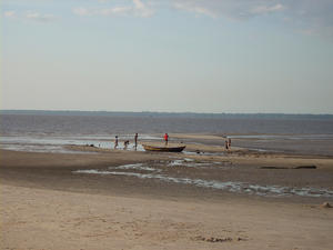
 Funda Beach - MAP Island Cotijuba has fifteen miles of coastline and its beaches are little explored.The beaches are lapped by the Bay of Marajo (look out for Marajo Island 11982) are preferred for swimming.The Funda Beach consists of a beautiful bay and is little frequented. Its name comes from having a steep terrain, which makes the beach a few steps from the deep edge.http://www.cotijuba.com/content/view/1/2/ Funda Beach - MAP Island Cotijuba has fifteen miles of coastline and its beaches are little explored.The beaches are lapped by the Bay of Marajo (look out for Marajo Island 11982) are preferred for swimming.The Funda Beach consists of a beautiful bay and is little frequented. Its name comes from having a steep terrain, which makes the beach a few steps from the deep edge.http://www.cotijuba.com/content/view/1/2/ |
| Grande Beach - MAP Extensive beach in the Mosqueiro Island, the Praia Grande even with the ebb tide, is hardly dry. Hence the reason for his preference for pequiniques. A little farther from town, is also the most popular night to the work of Umbanda. Beach mysterious dedicated to the deities, that there are offerings to their bodies from the sea. The colorful candle, sung by the mothers point of the saint dressed in white, dancing, the sound of the waves... |
 Ilha de Cotijuba Beach - MAP
Island Cotijuba has fifteen miles of coastline and its beaches are little explored. The beaches are lapped by the Bay of Marajo (look out for Marajo Island)11982 are preferred for swimming.
The most famous beach of Vai-quem-quer to be the largest and is little frequented. The Vai-Quem-Quer Beach is 9 miles from the island's port infrastructure and has simple, rustic inns and pubs serving homemade food.
... Ilha de Cotijuba Beach - MAP
Island Cotijuba has fifteen miles of coastline and its beaches are little explored. The beaches are lapped by the Bay of Marajo (look out for Marajo Island)11982 are preferred for swimming.
The most famous beach of Vai-quem-quer to be the largest and is little frequented. The Vai-Quem-Quer Beach is 9 miles from the island's port infrastructure and has simple, rustic inns and pubs serving homemade food.
... |
 Marahu Beach - MAP Extensive, beautiful, with its white sand and thick, is one of the most picturesque. There are no stones, with the constant pounding of waves, trnsformaram into strange sculptures. The water, like a giant conzel, the neatly shaped.Marahú - For being a port where the old ships that followed to Bethlehem when moored, were tied in Maras, threaded rod on the river banks for this purpose.http://praiasdemosqueiro.blogspot.com/2010/08/praia-d... Marahu Beach - MAP Extensive, beautiful, with its white sand and thick, is one of the most picturesque. There are no stones, with the constant pounding of waves, trnsformaram into strange sculptures. The water, like a giant conzel, the neatly shaped.Marahú - For being a port where the old ships that followed to Bethlehem when moored, were tied in Maras, threaded rod on the river banks for this purpose.http://praiasdemosqueiro.blogspot.com/2010/08/praia-d... |
 Mosqueiro Island - MAP is a river island located on the east coast Mosqueiro of the Pará River, the south arm of the Amazon River, opposite the Bay of Guajará. It has an area of approximately 212 km ².Mosqueiro possesses the municipality of Bethlehem and of this 40.5 km of continental Bethlehem. It has 17 km of beaches to freshwater tidal movement.Mosqueiro The name originates from the ancient practice of the indigenous fish moqueio tupinambás who i... Mosqueiro Island - MAP is a river island located on the east coast Mosqueiro of the Pará River, the south arm of the Amazon River, opposite the Bay of Guajará. It has an area of approximately 212 km ².Mosqueiro possesses the municipality of Bethlehem and of this 40.5 km of continental Bethlehem. It has 17 km of beaches to freshwater tidal movement.Mosqueiro The name originates from the ancient practice of the indigenous fish moqueio tupinambás who i... |
| Murubira Beach - MAP A tip, a "bay" and comes from the beach, whose name recalls the Indians who inhabited the island: the Murubira. On the edge, a retaining wall, sidewalk and a few palm trees. This beach has become very crowded with the opening of Hotel Murubira. Meeting of young people to flirt and become our Ipanema.Murubira: Tribe who lived in the local indigenous language or Murubira Morobe, as they called the Indians, means 'strong man' or 'stone man... |
 Outeiro Island - MAP
Outeiro Island
The Caratateua or Outeiro island, as it is known is located 28 km from Belém connected to the mainland by bridge Governor Enéas Martins, 360 m long. The area has fully urbanized beaches, where stalls serves snacks such as fish, shrimps and crabs. From the beaches, the most popular are Amor (Love) Beach 10880 and Brasília Beach 10898.
It houses the Environmental Education Center prof. Eidor... Outeiro Island - MAP
Outeiro Island
The Caratateua or Outeiro island, as it is known is located 28 km from Belém connected to the mainland by bridge Governor Enéas Martins, 360 m long. The area has fully urbanized beaches, where stalls serves snacks such as fish, shrimps and crabs. From the beaches, the most popular are Amor (Love) Beach 10880 and Brasília Beach 10898.
It houses the Environmental Education Center prof. Eidor... |
 Paraíso Beach - MAP Paradise Beach is a narrow strip of dark sand and coarse. Quietly, it has palm trees where it is possible to camp and there are good waves for surfing.http://www.apontador.com.br/local/pa/belem/diversoes/C4028206510855422A0D0A/praia_do_paraiso.htmlShould feel complete happiness promeiro those who discovered it. Eden. Pure white sand, the sun, the soft whisper of waves, palm trees and winding inclined lift their hearts and their cluster... Paraíso Beach - MAP Paradise Beach is a narrow strip of dark sand and coarse. Quietly, it has palm trees where it is possible to camp and there are good waves for surfing.http://www.apontador.com.br/local/pa/belem/diversoes/C4028206510855422A0D0A/praia_do_paraiso.htmlShould feel complete happiness promeiro those who discovered it. Eden. Pure white sand, the sun, the soft whisper of waves, palm trees and winding inclined lift their hearts and their cluster... |
 Porto Arthur Beach - MAP Beach which is named in honor of Arthur Teixeira Pires, the first to have a summer home there. In Port Arthur was the end of the cable car line drawn by donkeys, formerly used means of transport between the town and this place, across the road from Hat Face, today November 16th Av. Great beach for swimming and at night, excellent for fishing.Port Arthur: Tribute to Commander Arthur Pires Teixeira, one of the local pioneers.http://praias... Porto Arthur Beach - MAP Beach which is named in honor of Arthur Teixeira Pires, the first to have a summer home there. In Port Arthur was the end of the cable car line drawn by donkeys, formerly used means of transport between the town and this place, across the road from Hat Face, today November 16th Av. Great beach for swimming and at night, excellent for fishing.Port Arthur: Tribute to Commander Arthur Pires Teixeira, one of the local pioneers.http://praias... |
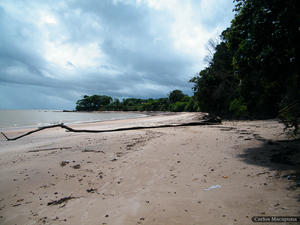
| São Francisco Beach - MAP Its name is an homage to the saint of ecology. Beach ideal for picnics. When does the tide, the waters recede enough, leaving a vast expanse of sand bathed by the sun. The forest still very close, the song of birds, the waves on the white sands give us recoil.San Francisco: Patron Saint of Ecology.http://praiasdemosqueiro.blogspot.com/2010/08/praia-do-sao-francisco.htmlThe beach of San Francisco has sand and thick and pale. The waves ar... |
| Saudade Beach - MAP |
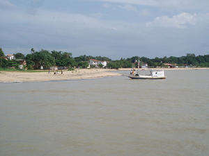
 Trapiche de Icoaraci Beach - MAP de onde partem os barcos para o Cotijuba. Trapiche de Icoaraci Beach - MAP de onde partem os barcos para o Cotijuba. |
| Vai-Quem-Quer Beach - MAP Island Cotijuba has fifteen miles of coastline and its beaches are little explored.The beaches are lapped by the Bay of Marajo (look out for Marajo Island 11982) are preferred for swimming.The most famous beach is Vai-quem-Quer to be the largest and is little frequented.The Vai-quem-Quer Beach is 9 miles from the island's port infrastructure and has simple, rustic inns and pubs serving homemade food.http://www.cotijuba.com/content/view/... |