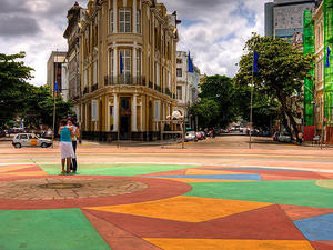
 Marco Zero Monument - MAP
Surrounded by a broad square and a labyrinth of narrow streets the Marco Zero Monument is located close to the waterfront and is often referred to simply as "Marco Zero". The landmark, in the district of Old Recife, is the starting point of the roads that cross the state, established in 1938 by the Automobile Club of Pernambuco.
The square, famous for Marco Zero in Recife, boasts a bust of the Baron of Rio Branco, ... Marco Zero Monument - MAP
Surrounded by a broad square and a labyrinth of narrow streets the Marco Zero Monument is located close to the waterfront and is often referred to simply as "Marco Zero". The landmark, in the district of Old Recife, is the starting point of the roads that cross the state, established in 1938 by the Automobile Club of Pernambuco.
The square, famous for Marco Zero in Recife, boasts a bust of the Baron of Rio Branco, ... |
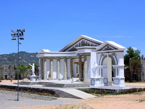 Brejo da Madre de Deus - MAP
The name of Heath Mother of God was given because of an accident of geography. It is a valley formed by the mountains of Prata, Estrago and Amaro where a priest of São Felipe Nery congregation founded a hospice on the banks of the creek named as Mother of God.
Due to its rocky formation, with dry ground and cold the climate, the Brejo da Madre de Deus (Mother of God Heath) has also served as the backdro... Brejo da Madre de Deus - MAP
The name of Heath Mother of God was given because of an accident of geography. It is a valley formed by the mountains of Prata, Estrago and Amaro where a priest of São Felipe Nery congregation founded a hospice on the banks of the creek named as Mother of God.
Due to its rocky formation, with dry ground and cold the climate, the Brejo da Madre de Deus (Mother of God Heath) has also served as the backdro... |
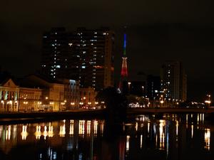 Cais da Aurora - MAP Pier AuroraSituated on the left bank of the river Capibaribe in the neighborhood of Boa Vista, the street was formerly a marsh owned by the merchant Antonio Casimiro Medeiros. The site was grounded and, in 1806, was born the streets of Aurora. It is so called because facing east is the first to receive the rays of the sun (dawn). Begins on the street and goes to the Empress Avenue North, as in Santo Amaro Cais da Aurora - MAP Pier AuroraSituated on the left bank of the river Capibaribe in the neighborhood of Boa Vista, the street was formerly a marsh owned by the merchant Antonio Casimiro Medeiros. The site was grounded and, in 1806, was born the streets of Aurora. It is so called because facing east is the first to receive the rays of the sun (dawn). Begins on the street and goes to the Empress Avenue North, as in Santo Amaro |
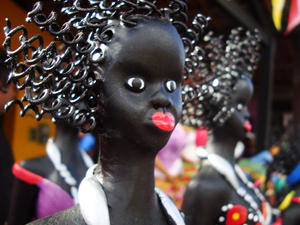 Caruaru - MAP 6 Caruaru is a municipality in the state of Pernambuco. Most populous city in the state, is located in the region of the Wasteland and due to its regional importance, is also known to its inhabitants as the Capital Wasteland and the Princess of the Wasteland.
Caruaru currently stands as the most important Brazilian "agreste" economic center, healthcare, academic, cultural and rural tourism. It is also famous for its traditional stree... Caruaru - MAP 6 Caruaru is a municipality in the state of Pernambuco. Most populous city in the state, is located in the region of the Wasteland and due to its regional importance, is also known to its inhabitants as the Capital Wasteland and the Princess of the Wasteland.
Caruaru currently stands as the most important Brazilian "agreste" economic center, healthcare, academic, cultural and rural tourism. It is also famous for its traditional stree... |
| Ipojuca - MAP Pojuca is a municipality in the state of Pernambuco, formed by the district headquarters, districts Camela, O Our Lady of the villages and beaches of Porto de Galinhas, Muro Alto, Cupe Maracaípe Serrambi, Touquinho, Suape and their mills.The colonization of Ipojuca began in 1560, after the expulsion of Caetés Indians and other tribes of the south coast of Pernambuco. From there, the settlers could migrate to the fertile land and rich ... |
 Patio de Sao Pedro - MAP St. Peter's Square
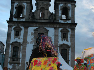
Central to Recife's flamboyant annual carnival celebrations, the Patio de Sao Pedro is famed for its beautiful colonial buildings, which are painted in bright colours. This spacious pedestrianised public square is bordered by a more than ample selection of restaurants and bars, although it is the wonderful architecture of the Concatedral de Sao Pedro dos Clérigos (Church of Saint Peter of Clerics) that... Patio de Sao Pedro - MAP St. Peter's Square
Central to Recife's flamboyant annual carnival celebrations, the Patio de Sao Pedro is famed for its beautiful colonial buildings, which are painted in bright colours. This spacious pedestrianised public square is bordered by a more than ample selection of restaurants and bars, although it is the wonderful architecture of the Concatedral de Sao Pedro dos Clérigos (Church of Saint Peter of Clerics) that... |
 Praca da Republica - MAP
Republic Square
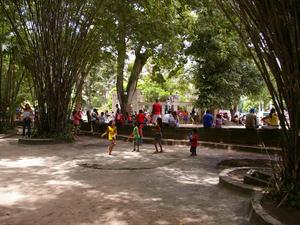
Located on the northern side of the central island of Sao Antonio (Santo Antonio), the Praca da Republica is surrounded by prominent buildings and imposing architecture dating from the 19th century. The Republic Square comprises a small formally landscaped park with fountains and seating, being a popular place to sit and eat at lunchtime. Just a short distance to the south is the is the magnificent Capela Do... Praca da Republica - MAP
Republic Square
Located on the northern side of the central island of Sao Antonio (Santo Antonio), the Praca da Republica is surrounded by prominent buildings and imposing architecture dating from the 19th century. The Republic Square comprises a small formally landscaped park with fountains and seating, being a popular place to sit and eat at lunchtime. Just a short distance to the south is the is the magnificent Capela Do... |
| Recife District - This was where Recife first started, the city”s initial settlement and, at present, its historical center. This important neighborhood displays several remodeled centenary constructions that have been used as bars, restaurants, theaters, museums, art galleries, shopping centers, as well as other architectonic complexes of priceless value.The first synagogue of the Americas is located on the blocks that form Old Recife, as it is also k... |
 Walking through the historic center of Olinda - MAP
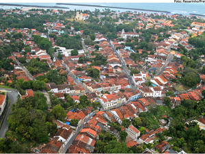
Strolling the hills of Olinda is the best way to see the beautiful houses, churches, landscapes and still enjoy the city's climate. Start the Praça do Carmo and head toward the street Amparo, full of museums, art galleries, restaurants and the House of Giants Dolls, where they are stored for the puppets parade during Carnival. If it is a Sunday, go to the Largo Varadouro to circulate in the craft fair, and at fall, follow ... Walking through the historic center of Olinda - MAP
Strolling the hills of Olinda is the best way to see the beautiful houses, churches, landscapes and still enjoy the city's climate. Start the Praça do Carmo and head toward the street Amparo, full of museums, art galleries, restaurants and the House of Giants Dolls, where they are stored for the puppets parade during Carnival. If it is a Sunday, go to the Largo Varadouro to circulate in the craft fair, and at fall, follow ... |
 Marco Zero Monument - MAP
Surrounded by a broad square and a labyrinth of narrow streets the Marco Zero Monument is located close to the waterfront and is often referred to simply as "Marco Zero". The landmark, in the district of Old Recife, is the starting point of the roads that cross the state, established in 1938 by the Automobile Club of Pernambuco.
The square, famous for Marco Zero in Recife, boasts a bust of the Baron of Rio Branco, ...
 Brejo da Madre de Deus - MAP
The name of Heath Mother of God was given because of an accident of geography. It is a valley formed by the mountains of Prata, Estrago and Amaro where a priest of São Felipe Nery congregation founded a hospice on the banks of the creek named as Mother of God.
Due to its rocky formation, with dry ground and cold the climate, the Brejo da Madre de Deus (Mother of God Heath) has also served as the backdro...
 Cais da Aurora - MAP Pier AuroraSituated on the left bank of the river Capibaribe in the neighborhood of Boa Vista, the street was formerly a marsh owned by the merchant Antonio Casimiro Medeiros. The site was grounded and, in 1806, was born the streets of Aurora. It is so called because facing east is the first to receive the rays of the sun (dawn). Begins on the street and goes to the Empress Avenue North, as in Santo Amaro
 Caruaru - MAP 6 Caruaru is a municipality in the state of Pernambuco. Most populous city in the state, is located in the region of the Wasteland and due to its regional importance, is also known to its inhabitants as the Capital Wasteland and the Princess of the Wasteland.
Caruaru currently stands as the most important Brazilian "agreste" economic center, healthcare, academic, cultural and rural tourism. It is also famous for its traditional stree...
 Patio de Sao Pedro - MAP St. Peter's Square
Central to Recife's flamboyant annual carnival celebrations, the Patio de Sao Pedro is famed for its beautiful colonial buildings, which are painted in bright colours. This spacious pedestrianised public square is bordered by a more than ample selection of restaurants and bars, although it is the wonderful architecture of the Concatedral de Sao Pedro dos Clérigos (Church of Saint Peter of Clerics) that...
 Praca da Republica - MAP
Republic Square
Located on the northern side of the central island of Sao Antonio (Santo Antonio), the Praca da Republica is surrounded by prominent buildings and imposing architecture dating from the 19th century. The Republic Square comprises a small formally landscaped park with fountains and seating, being a popular place to sit and eat at lunchtime. Just a short distance to the south is the is the magnificent Capela Do...
 Walking through the historic center of Olinda - MAP
Strolling the hills of Olinda is the best way to see the beautiful houses, churches, landscapes and still enjoy the city's climate. Start the Praça do Carmo and head toward the street Amparo, full of museums, art galleries, restaurants and the House of Giants Dolls, where they are stored for the puppets parade during Carnival. If it is a Sunday, go to the Largo Varadouro to circulate in the craft fair, and at fall, follow ...