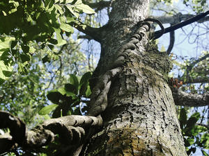
 Botanical Garden - MAP 3
The Botanic Garden of Porto Alegre was opened in 1958 with the exhibition of the first collections of palms, conifers, cactus, agave and lily. From 1974 were created botanical collections of tree species (Arboretum) organized by forest formations, botanical families and thematic groups. It has an area of 39 ha.
It is currently considered one of the five largest botanical gardens in Brazil du... Botanical Garden - MAP 3
The Botanic Garden of Porto Alegre was opened in 1958 with the exhibition of the first collections of palms, conifers, cactus, agave and lily. From 1974 were created botanical collections of tree species (Arboretum) organized by forest formations, botanical families and thematic groups. It has an area of 39 ha.
It is currently considered one of the five largest botanical gardens in Brazil du... |
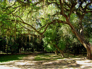 Farroupilha or Redenção Park - MAP Farroupilha Park, also known as Redenção Park, is the most traditional and popular park in Porto Alegre, as a spot traditionally visited by Porto Alegre citizens in the hours of rest, either for sports or simply to drink a chimarrão with the family. The perimeter of the park is set on streets Setembrino and Luis Englert, and avenues Oswaldo Aranha, Joao Pessoa and Jose Bonifacio.The story of Farroupilha Park merges with the history o... Farroupilha or Redenção Park - MAP Farroupilha Park, also known as Redenção Park, is the most traditional and popular park in Porto Alegre, as a spot traditionally visited by Porto Alegre citizens in the hours of rest, either for sports or simply to drink a chimarrão with the family. The perimeter of the park is set on streets Setembrino and Luis Englert, and avenues Oswaldo Aranha, Joao Pessoa and Jose Bonifacio.The story of Farroupilha Park merges with the history o... |
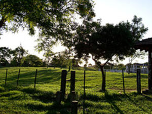 Maurício Sirotsky Sobrinho Park - MAP It is also known as Harmony Park. It opened in 1982 and has 300 thousand square meters. Through union with the Marine Park of Brazil, forming a large green belt that hugs the Guaíba.The park hosts in its area, a replica of the gaucho, the Harmonia Ranch, designed to maintain and practice of traditional culture, and we could even rent horses for rides.It also has places for children, soccer, bocce and volleyball courts.Gather your frien... Maurício Sirotsky Sobrinho Park - MAP It is also known as Harmony Park. It opened in 1982 and has 300 thousand square meters. Through union with the Marine Park of Brazil, forming a large green belt that hugs the Guaíba.The park hosts in its area, a replica of the gaucho, the Harmonia Ranch, designed to maintain and practice of traditional culture, and we could even rent horses for rides.It also has places for children, soccer, bocce and volleyball courts.Gather your frien... |
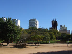 Moinhos De Vento Park - MAP Moinhos de Vento Park is surrounded by streets 24 de Outubro, Mostardeiro, Comendador Caminha, Quintino Bocaiuva and cut by Goethe Av.The Parcão, as it is also known for Porto Alegre citizens, was officially created in 1972, and has 115 thousand square meters and is located in the sophisticated district bearing the same name.The toponym "windmills" has been assigned by virtue of the existence in its area of mills that turned the wheat... Moinhos De Vento Park - MAP Moinhos de Vento Park is surrounded by streets 24 de Outubro, Mostardeiro, Comendador Caminha, Quintino Bocaiuva and cut by Goethe Av.The Parcão, as it is also known for Porto Alegre citizens, was officially created in 1972, and has 115 thousand square meters and is located in the sophisticated district bearing the same name.The toponym "windmills" has been assigned by virtue of the existence in its area of mills that turned the wheat... |
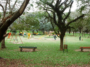 Parque Marinha do Brasil - MAP The Park was opened in 1978, occupies an area of 715 square meters and its name pays homage to Brazil's Navy.
Built on the landfill area bordering the Guaíba nurture a very special contact with its waters.
It is one of the places preferred by athletes who occupy, especially on weekends, four tennis courts, five multipurpose courts, a soccer field, six indoor football, a running track, a skating rink, a skateboard, nine... Parque Marinha do Brasil - MAP The Park was opened in 1978, occupies an area of 715 square meters and its name pays homage to Brazil's Navy.
Built on the landfill area bordering the Guaíba nurture a very special contact with its waters.
It is one of the places preferred by athletes who occupy, especially on weekends, four tennis courts, five multipurpose courts, a soccer field, six indoor football, a running track, a skating rink, a skateboard, nine... |
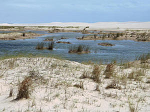 Parque Nacional da Lagoa do Peixe - MAP 4
The Fish Lagoon National Park is located on the southern coast of Rio Grande do Sul, covering the cities of Tavares (80%), Mostardas (17%) and São José do Norte (3%). The unit has an area of 34,400 hectares and a perimeter of 138.84 km (cartographic calculation). It is administered by the Chico Mendes Institute for Biodiversity Conservation (ICMBio). The nearest towns are Tavares... Parque Nacional da Lagoa do Peixe - MAP 4
The Fish Lagoon National Park is located on the southern coast of Rio Grande do Sul, covering the cities of Tavares (80%), Mostardas (17%) and São José do Norte (3%). The unit has an area of 34,400 hectares and a perimeter of 138.84 km (cartographic calculation). It is administered by the Chico Mendes Institute for Biodiversity Conservation (ICMBio). The nearest towns are Tavares... |
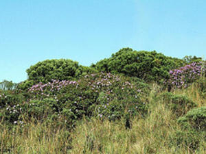 Parque Nacional da Serra Geral - MAP The Serra Geral National Park is situated on the border of the states of Rio Grande do Sul and Santa Catarina, Serra Geral National Park was created by Decree No. 531 of 20.05.1992 and is adjacent to National Park of Sierra Aparados, constituting an ecosystem of rare beauty and important area for biodiversity for scientific, cultural and recreational services. It is administered by the Chico Mendes Institute for Biodiversity Conservatio... Parque Nacional da Serra Geral - MAP The Serra Geral National Park is situated on the border of the states of Rio Grande do Sul and Santa Catarina, Serra Geral National Park was created by Decree No. 531 of 20.05.1992 and is adjacent to National Park of Sierra Aparados, constituting an ecosystem of rare beauty and important area for biodiversity for scientific, cultural and recreational services. It is administered by the Chico Mendes Institute for Biodiversity Conservatio... |
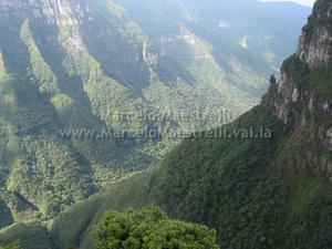 Parque Nacional de Aparados da Serra - MAP
Deep valleys, with up to 900m high, lined with pines. Its edges waterfalls plummet up to 720m. Cold and damp and the fog that surrounds these formations are likely to enjoy a true mate. This is the scenario where the five largest canyons in the country. A spectacular landscape threatened by deforestation of Araucaria even though a region of environmental preservation. His creation is old: 1959. The oldest are the canyons that began f... Parque Nacional de Aparados da Serra - MAP
Deep valleys, with up to 900m high, lined with pines. Its edges waterfalls plummet up to 720m. Cold and damp and the fog that surrounds these formations are likely to enjoy a true mate. This is the scenario where the five largest canyons in the country. A spectacular landscape threatened by deforestation of Araucaria even though a region of environmental preservation. His creation is old: 1959. The oldest are the canyons that began f... |
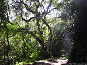 Parque Natural Morro do Osso - MAP The Morro do Osso, with 143m high, is part of the chain of granite hills in Porto Alegre city and is located near the shore of Lake Guaíba. It has 220 acres of natural area and constitutes an important biological stronghold, virtually isolated by the urbanization of sadness neighborhoods, Ipanema, and Camaquã Cavalhada, adjacent to the hill. From the top of the hill has become one of the most beautiful sights in the ... Parque Natural Morro do Osso - MAP The Morro do Osso, with 143m high, is part of the chain of granite hills in Porto Alegre city and is located near the shore of Lake Guaíba. It has 220 acres of natural area and constitutes an important biological stronghold, virtually isolated by the urbanization of sadness neighborhoods, Ipanema, and Camaquã Cavalhada, adjacent to the hill. From the top of the hill has become one of the most beautiful sights in the ... |
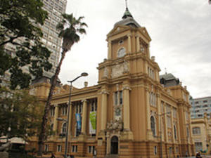 Praça da Alfândega - MAP Da Alfândega Square is a historic square, located in downtown Porto AlegPraça da Alfândega, Rua Siqueira Campos, Porto Alegre, Rio Grande do Sul, Brazilre, near the lake Guaíba, and being surrounded by important buildings, some of them historical, such as Santander Cultural, the MARGS, Memorial do Rio Grande do Sul, the former Cine Guarany the headquarters of BANRISUL Rua da Praia Shopping, among others.Its origin dates from the lat... Praça da Alfândega - MAP Da Alfândega Square is a historic square, located in downtown Porto AlegPraça da Alfândega, Rua Siqueira Campos, Porto Alegre, Rio Grande do Sul, Brazilre, near the lake Guaíba, and being surrounded by important buildings, some of them historical, such as Santander Cultural, the MARGS, Memorial do Rio Grande do Sul, the former Cine Guarany the headquarters of BANRISUL Rua da Praia Shopping, among others.Its origin dates from the lat... |
| Terra dos Gnomos e Duendes - MAP "Land of the Gnomes and Elves" is a Thematic Park for recreation, interactive activities, rent for birthday parties, and trips for pre-school children.Address: Rua Olavo Barreto Viana, 36 - Porto Alegre - RS, 90570-070, BrazilPhone Number: 51 33467677Homepage:http://www.terradosgnomos.com.br |
 Botanical Garden - MAP 3
The Botanic Garden of Porto Alegre was opened in 1958 with the exhibition of the first collections of palms, conifers, cactus, agave and lily. From 1974 were created botanical collections of tree species (Arboretum) organized by forest formations, botanical families and thematic groups. It has an area of 39 ha.
It is currently considered one of the five largest botanical gardens in Brazil du...
 Farroupilha or Redenção Park - MAP Farroupilha Park, also known as Redenção Park, is the most traditional and popular park in Porto Alegre, as a spot traditionally visited by Porto Alegre citizens in the hours of rest, either for sports or simply to drink a chimarrão with the family. The perimeter of the park is set on streets Setembrino and Luis Englert, and avenues Oswaldo Aranha, Joao Pessoa and Jose Bonifacio.The story of Farroupilha Park merges with the history o...
 Maurício Sirotsky Sobrinho Park - MAP It is also known as Harmony Park. It opened in 1982 and has 300 thousand square meters. Through union with the Marine Park of Brazil, forming a large green belt that hugs the Guaíba.The park hosts in its area, a replica of the gaucho, the Harmonia Ranch, designed to maintain and practice of traditional culture, and we could even rent horses for rides.It also has places for children, soccer, bocce and volleyball courts.Gather your frien...
 Moinhos De Vento Park - MAP Moinhos de Vento Park is surrounded by streets 24 de Outubro, Mostardeiro, Comendador Caminha, Quintino Bocaiuva and cut by Goethe Av.The Parcão, as it is also known for Porto Alegre citizens, was officially created in 1972, and has 115 thousand square meters and is located in the sophisticated district bearing the same name.The toponym "windmills" has been assigned by virtue of the existence in its area of mills that turned the wheat...
 Parque Marinha do Brasil - MAP The Park was opened in 1978, occupies an area of 715 square meters and its name pays homage to Brazil's Navy.
Built on the landfill area bordering the Guaíba nurture a very special contact with its waters.
It is one of the places preferred by athletes who occupy, especially on weekends, four tennis courts, five multipurpose courts, a soccer field, six indoor football, a running track, a skating rink, a skateboard, nine...
 Parque Nacional da Lagoa do Peixe - MAP 4
The Fish Lagoon National Park is located on the southern coast of Rio Grande do Sul, covering the cities of Tavares (80%), Mostardas (17%) and São José do Norte (3%). The unit has an area of 34,400 hectares and a perimeter of 138.84 km (cartographic calculation). It is administered by the Chico Mendes Institute for Biodiversity Conservation (ICMBio). The nearest towns are Tavares...
 Parque Nacional da Serra Geral - MAP The Serra Geral National Park is situated on the border of the states of Rio Grande do Sul and Santa Catarina, Serra Geral National Park was created by Decree No. 531 of 20.05.1992 and is adjacent to National Park of Sierra Aparados, constituting an ecosystem of rare beauty and important area for biodiversity for scientific, cultural and recreational services. It is administered by the Chico Mendes Institute for Biodiversity Conservatio...
 Parque Nacional de Aparados da Serra - MAP
Deep valleys, with up to 900m high, lined with pines. Its edges waterfalls plummet up to 720m. Cold and damp and the fog that surrounds these formations are likely to enjoy a true mate. This is the scenario where the five largest canyons in the country. A spectacular landscape threatened by deforestation of Araucaria even though a region of environmental preservation. His creation is old: 1959. The oldest are the canyons that began f...
 Parque Natural Morro do Osso - MAP The Morro do Osso, with 143m high, is part of the chain of granite hills in Porto Alegre city and is located near the shore of Lake Guaíba. It has 220 acres of natural area and constitutes an important biological stronghold, virtually isolated by the urbanization of sadness neighborhoods, Ipanema, and Camaquã Cavalhada, adjacent to the hill. From the top of the hill has become one of the most beautiful sights in the ...
 Praça da Alfândega - MAP Da Alfândega Square is a historic square, located in downtown Porto AlegPraça da Alfândega, Rua Siqueira Campos, Porto Alegre, Rio Grande do Sul, Brazilre, near the lake Guaíba, and being surrounded by important buildings, some of them historical, such as Santander Cultural, the MARGS, Memorial do Rio Grande do Sul, the former Cine Guarany the headquarters of BANRISUL Rua da Praia Shopping, among others.Its origin dates from the lat...